
Sunday, April 15, 2018
TCT #5 -- Preston Falls, Groveland

Saturday, April 14, 2018
Trip Report - Melones Railroad Grade, 4/7/18

Ranger Hilary Maxworthy of the Bureau of Reclamation promised to take us on a wildflower hike, and boy, she delivered! As about 30 Trail Heads gathered in an April shower to walk the usually restricted (Homeland Security) Melones Railroad Grade in the Peoria area near Jamestown, we were immediately treated to tiny Butter and Eggs carpeting the parking area of the Equestrian Staging Area. While she was awaiting us, Ranger Hilary said that she watched an Osprey return with a fish to a nest in a nearby power pole. A promising start to our hike!

 The overnight “atmospheric river” and continuing light drizzle rendered the trail – normally dirt – into sloppy, slippery mud. We had to watch our footing, and many of us used hiking poles for stability. This initial section of the route took us through a grassy, green oak woodland with rolling hills and inspiring views ending in distant mist. And Brewers Lupine, lots and lots of lupine. After about 3/4-mile, we were rain-free and soon on the well-drained railroad grade which we followed for most of our 4.25 mile hike. The railroad grade was hewn out of the north-facing wall of the Stanislaus River canyon to get materials out to the construction site of the original Melones Dam (now beneath the waters of New Melones Lake). This provides a protected environment for diminutive, delicate wildflowers. Some of the names I remember are Fairy Lantern, Chinese House, Sticky Monkeyflower, Seep-spring
The Peoria area of New Melones Lake is northwest of Jamestown. Take O’Byrnes Ferry Rd. toward Copperopolis. Turn right at New Peoria Flat Rd. (the sign for “Baseline Conservation Camp” is prominent). Take a hard right at the Baseline Conservation Camp onto Old Melones Dam Rd. The first trailhead is on the left, the Equestrian Staging Area with a port-a-potty and ample parking. The second trailhead is further up Old Melones Dam Rd. at the closed gate. There is limited parking here.
 We were originally going to use this second trailhead for our Peoria area outing which was to be a 4-mile loop up the strenuous Peoria Mountain trail with a moderate traverse to the ridge then down via the Green Springs trail. Because of its low elevation, the Peoria area is accessible year-round. It's especially lovely in the spring with poppies, vetch, green grass, and oaks leafing-out. However, it can be very hot in late spring and summer -- bring WATER! It's also popular with deer hunters during the season -- wear ORANGE! If you go on our own, be aware that this area isn't well-signed; you'll have to use your "trail sense" to find your way. However, the trails seem to connect and it’s fairly easy to get oriented due to the prominent landmarks of the lake and/or the mountain.
Here's a map of the trails in the Peoria area:
https://www.usbr.gov/mp/ccao/newmelones/docs/maps/map-peoria-wildlife-area.pdf
Here's a map of all the trails at New Melones Lake:
https://www.usbr.gov/mp/ccao/newmelones/docs/maps/map-peoria-wildlife-area.pdf
Here's a map of all the trails at New Melones Lake:
https://www.usbr.gov/mp/ccao/newmelones/docs/maps/map-new-melones-lake-trail.pdf
Listen to the May TCT radio program for Trail Head reviews of the New Melones RR Grade Wildflower Hike.
Listen to the May TCT radio program for Trail Head reviews of the New Melones RR Grade Wildflower Hike.
Saturday, March 24, 2018
TCT #4 -- Melones Railroad Grade, Jamestown/Peoria Flat

Sunday, March 4, 2018
Trip Report - Table Mountain, 3/3/18

Any elevation above 2000’ woke up to snow the morning of our hike to Table Mountain in Jamestown. Though he had to dig out at home, Ranger Mike McGraw and two other Bureau of Reclamation rangers met us at the Shell Road trailhead. As 15 hikers gathered in the cold sun, it was apparent we’d lucked into a lengthy break in the late winter storm.

 With an inspirational quote from “Zen and the Art of
Motorcycle Maintenance” author Robert Prisig, Ranger Mike, in his calm yet
enthusiastic way, set the tone of deliberate inquiry and delightful
discovery. Our hike took us through four
distinct ecosystems: savannah,
chaparral, oak woodland, and vernal pools. On the way we learned of the introduction of
invasive grass species and their impact on the native plants (sapping deep
water reserves, encouraging erosion). We
touched on geology including the ancient sea that had its shores near Oakdale
and the lava flow originating up near Sonora Pass that filled the Stanislaus
River and ultimately created the nearly 60-mile-long “inverted river bed” that
is Table Mountain. We discussed the
prehistoric climate of the area, the mega flora and fauna that once existed and
plants and animals that live here now including the largest bat in North
America, the western mastiff bat.
With an inspirational quote from “Zen and the Art of
Motorcycle Maintenance” author Robert Prisig, Ranger Mike, in his calm yet
enthusiastic way, set the tone of deliberate inquiry and delightful
discovery. Our hike took us through four
distinct ecosystems: savannah,
chaparral, oak woodland, and vernal pools. On the way we learned of the introduction of
invasive grass species and their impact on the native plants (sapping deep
water reserves, encouraging erosion). We
touched on geology including the ancient sea that had its shores near Oakdale
and the lava flow originating up near Sonora Pass that filled the Stanislaus
River and ultimately created the nearly 60-mile-long “inverted river bed” that
is Table Mountain. We discussed the
prehistoric climate of the area, the mega flora and fauna that once existed and
plants and animals that live here now including the largest bat in North
America, the western mastiff bat.
 Scrambling up the steep side as we pushed toward the summit,
we passed a seasonal cascade. The broad
table-top of the mountain was practically one continuous vernal pool filled to
overflowing with fresh, cold water from the overnight storm. Any invertebrates in the pools hadn’t brewed
yet or they’d washed away! What we
missed on the micro-scale we made up for on the macro: clear, expansive views
to snow-covered Duckwall Mountain, the peaks further off in Yosemite, and New
Melones Lake.
Scrambling up the steep side as we pushed toward the summit,
we passed a seasonal cascade. The broad
table-top of the mountain was practically one continuous vernal pool filled to
overflowing with fresh, cold water from the overnight storm. Any invertebrates in the pools hadn’t brewed
yet or they’d washed away! What we
missed on the micro-scale we made up for on the macro: clear, expansive views
to snow-covered Duckwall Mountain, the peaks further off in Yosemite, and New
Melones Lake.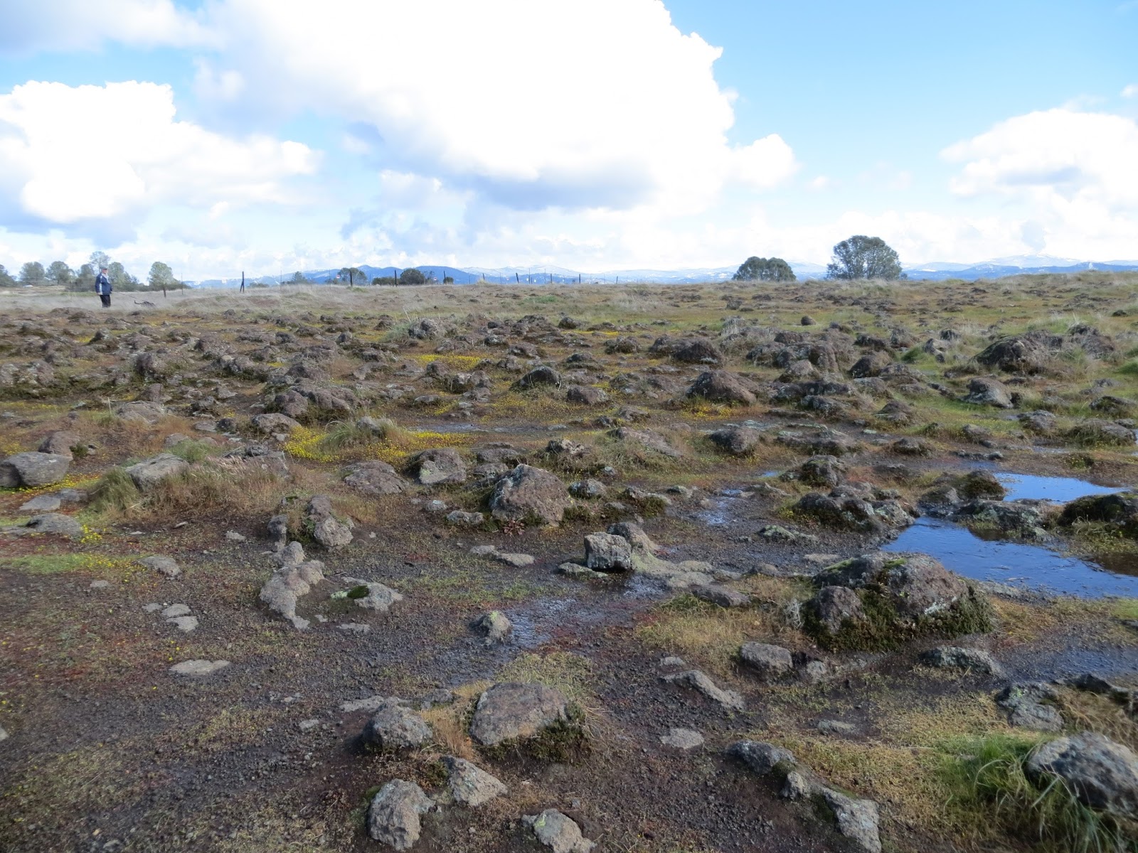 The main Table Mountain trailhead is at the end of Shell Rd.
in Jamestown (off of Rawhide Rd.). The
road dead ends at a closed (though not locked) gate. The road is narrow; park as far off to the
side as possible. To the right of the
gate across the road is a person-sized gate where the trail begins. This section of trail is a pleasant stroll
through savannah and roughly parallels the road. (If you have a high-clearance vehicle, you
can open the gate at the trailhead and drive to the next gate, shortening the
hike by about a mile and missing the lovely oak grassland). The trail takes you directly to a pit toilet;
turn left, go through a gate, cross the road, go through another gate then
continue uphill through the chaparral.
There’s signage, but it’s on the “discreet” side; you may have to use
your “trail sense.” Keep left on the way
up the switchbacks. You’ll have a short
scramble over a rocky patch just before the final push to the top. Then your reward: The table top of Table Mountain, always with
views and in the spring a bonus of wildflowers and vernal pools.
The main Table Mountain trailhead is at the end of Shell Rd.
in Jamestown (off of Rawhide Rd.). The
road dead ends at a closed (though not locked) gate. The road is narrow; park as far off to the
side as possible. To the right of the
gate across the road is a person-sized gate where the trail begins. This section of trail is a pleasant stroll
through savannah and roughly parallels the road. (If you have a high-clearance vehicle, you
can open the gate at the trailhead and drive to the next gate, shortening the
hike by about a mile and missing the lovely oak grassland). The trail takes you directly to a pit toilet;
turn left, go through a gate, cross the road, go through another gate then
continue uphill through the chaparral.
There’s signage, but it’s on the “discreet” side; you may have to use
your “trail sense.” Keep left on the way
up the switchbacks. You’ll have a short
scramble over a rocky patch just before the final push to the top. Then your reward: The table top of Table Mountain, always with
views and in the spring a bonus of wildflowers and vernal pools.
Table Mountain is a moderate, low-elevation hike that’s
accessible year-round. It’s only a
3-mile round trip and makes a nice “quickie” outing if you’re strapped for
time. You may extend your hike via
trails that link Table Mountain with the Peoria area or by heading down to the
lake via a spur off the main approach trail.
From the parking area to the mountain-top, there is private property all
around. Please respect the neighborhood
and boundaries. There are no services
other than the pit toilet; bring water!
Here's a map of the Table Mountain trail:
Here's a map of all the trails at New Melones Lake:
Saturday, March 3, 2018
TCT #3 -- Table Mountain, Jamestown

Sunday, February 4, 2018
Trip Report - Red Hills ACEC, 2/3/18

 Hike day dawned unseasonably warm for early February. The beautiful weather brought out a mob of
50-70 hikers to the trailhead! After a
brief orientation by Bureau of Land Management volunteer ranger Patrick
Congdon, the crowd quickly separated into more intimate clumps of 5-10 hikers
and dispersed along the trail. We were a
little early for the Red Hills’ claim-to-fame, the wildflowers. Instead we appreciated the geologic features (serpentine
rock, ultramafic soils, etc.) and plants which have adapted to this
nutrient-deficient environment (Foothills pine, Buckbrush, etc). While each group mayhave taken a slightly
different route with varying hike lengths, we all started at the North
Serpentine Road trailhead and walked along Horton Creek for a time. Some traversed the hills to South Serpentine
Road and looped back up to the starting point.
Some lingered on the Nature Trail studying the panels. Some saw a fox!
Hike day dawned unseasonably warm for early February. The beautiful weather brought out a mob of
50-70 hikers to the trailhead! After a
brief orientation by Bureau of Land Management volunteer ranger Patrick
Congdon, the crowd quickly separated into more intimate clumps of 5-10 hikers
and dispersed along the trail. We were a
little early for the Red Hills’ claim-to-fame, the wildflowers. Instead we appreciated the geologic features (serpentine
rock, ultramafic soils, etc.) and plants which have adapted to this
nutrient-deficient environment (Foothills pine, Buckbrush, etc). While each group mayhave taken a slightly
different route with varying hike lengths, we all started at the North
Serpentine Road trailhead and walked along Horton Creek for a time. Some traversed the hills to South Serpentine
Road and looped back up to the starting point.
Some lingered on the Nature Trail studying the panels. Some saw a fox! Here's a link to the Bureau of Land Management's information page on the Red Hills ACEC:
Saturday, February 3, 2018
TCT #2 -- Red Hills ACEC, Chinese Camp

Subscribe to:
Posts (Atom)