Our June hike falls on National Trails Day. It's the 50th anniversary of the National Trails Act; celebrate with a hike! We're taking my favorite hike in the county, the Sugar Pine Railroad Grade section from Fraser Flat to Strawberry (and back). This is an easy hike though, at 7 miles, on the longer side. It's a lovely, shaded meander along the Stanislaus River.
On-leash dogs welcome. Bring water, snacks and/or lunch. Dress in layers; wear a hat.
The hike starts at 9. The trailhead is on the south side of the bridge just before Fraser Flat Campground. To minimize parking congestion at the trailhead, we'll be carpooling/caravanning from the Starbuck's at the Junction. Carpool leaves at 8:30.
Showing posts with label Tuolumne County Trailhead. Show all posts
Wednesday, May 23, 2018
Thursday, May 10, 2018
Trip Report - Preston Falls, 5/5/18
![]() |
| photo by Joey Partridge |
About 20 of us carpooled and caravanned from Jamestown and
Groveland, and about 10 more met us at the trailhead. The adventure started pretty much as soon as
we hit the road: We halted for a cattle
drive at the intersection of Jacksonville and Stent Roads! We proceeded unhindered through Groveland and
Buck Meadows, past the Rim of the World vista point and Rainbow Pools, turning
onto Cherry Lake Road and into the heart of the Rim Fire burn area. Cherry Lake Road is narrow, winding and
scales ridges which afford stunning views into the Tuolumne River canyon and
the snowy peaks of Yosemite and Sonora Pass.
At the highest on the road, we were at about 4,000’ but quickly dove
into the canyon and reached river-level at 2,400’. Thank goodness for low gear!
We were fortunate to have interpretative specialists along
on the hike, this time Seth Connolly of the Tuolumne River Trust with his
companion, Ariel, an Americorps volunteer.
Seth gave a brief orientation, mentioning that a work crew of American
Hiking Society members on a volunteer vacation were due to start rehabbing the trail
the next day. Then we were off,
immediately encountering projects and hazards for the AHS volunteers: downed
trees blocking the trail and huge, healthy poison oak stands with tendrils
extending into the trail. Thank goodness
for Tecnu!
It was slightly overcast, and the diffused light made
photography a joy. The river was a
dynamic subject, rushing in places, wide and still in others, and crashing
through its rocky gorge in yet others.
There were wildflowers galore (Bush Lupine, California Indian Pink,
Paintbrush, Baby Blue Eyes, Tufted Poppies, Mustang Clover, Common Madia,
Brewer’s Lupine, Fivespot, Lindley’s Siverpuffs). We enjoyed the shade of pines and
moss-covered oaks. We crept through a
charred skeleton tree forest, remnants of the Rim Fire’s devastation. We heard birds but didn’t see many;
butterflies were the prevalent winged creatures. Someone spotted a slithering creature – a
small rattlesnake. Thank goodness the
dogs steered clear!
At the falls we picnicked, napped, and cooled our toes in
the Tuolumne. As we geared up to hike
out, Seth offered motivation: The AHS
volunteers had invited us to stop by for cookies and tea after we returned to
the trailhead!
Due to the low elevation, this trail is open year-round,
though there may be issues with access if it happens to be snowy or icy on the
access roads or highway. To get to the
trailhead, take Cherry Lake Rd. from Highway 120 (east of Groveland, Buck
Meadows, the Rim of the World vista point, and Rainbow Pools). After many gorgeous miles on the narrow,
winding road, you’ll come to a distinct fork – take the left (right takes you
to Camp Mather and Hetch Hetchy), which continues as Cherry Lake Rd. You’ll immediately begin your descent into
the river canyon. You’ll reach a bridge
at river-level; cross the bridge then turn right. Drive on past the houses, buildings,
powerhouse; the road dead ends at the trailhead. There’s plenty of parking, a vault toilet,
and a bear box.
Here's a link to the Stanislaus National Forest webpage about Preston Falls:
Here's a link to a nice California State Parks flyer about the Tuolumne River (with a map):
Wednesday, April 18, 2018
Prepping for the May program
4/18/18 -- Just back from a meeting with Lisa DeHart, the archaeologist for the Summit Ranger District, Stanislaus National Forest. Quite an interesting talk about our steady march up Highway 108 to Sonora Pass starting with the June hike on the Sugar Pine Railroad Grade, Strawberry Branch then the July hike to Relief Reservoir and finally the September hike to Sonora Peak/Stanislaus Peak. We're basically reversing and intersecting the route of the early emigrants. I'm having a time wrapping my mind about what they went through with those wagons and those mountains! Anyway, looking forward to the hikes and putting together what I hope is a compelling program for May. And, our June hike, Saturday 6/2/18, falls on NATIONAL TRAILS DAY! You gotta make it to this hike!
Sunday, April 15, 2018
TCT #5 -- Preston Falls, Groveland
Save Cinco de Mayo for an expedition to Preston Falls in the Wild and Scenic Tuolumne River Gorge east of Groveland. View the effects of the Rim Fire and the restoration efforts of the Forest Service and various agencies, organizations, and volunteers. Seth Connolly of the Tuolumne River Trust and a few AmeriCorps volunteers will come along and offer interpretation and insight. The hike is 8 miles round trip without much elevation gain but considered moderate due to distance, exposure, trail surface, uneven footing, and stepping on and over rocks. Allow all day for this hike due the distance to the trailhead and the length of the hike. We will hike from 10am until about 4pm. Carpoolers/caravaners meet at 8:15am at the Jamestown Day-O Espresso stand. We will leave by 8:30. Those not carpooling or caravanning may meet us at the trailhead: Early Intake/Kirkwood Powerhouse off of Cherry Lake Rd (Forest Road 1N07) outside of Groveland/Buck Meadows. On-leash dogs are OK, but Seth warns that there's a lot of poison oak, and, in his experience, folks who bring dogs tend not to make it to the falls (the poochies get pooped). Dress in layers and wear a hat. Bring sunscreen, water, lunch and cameras.
Saturday, April 14, 2018
Trip Report - Melones Railroad Grade, 4/7/18
Ranger Hilary Maxworthy of the Bureau of Reclamation promised to take us on a wildflower hike, and boy, she delivered! As about 30 Trail Heads gathered in an April shower to walk the usually restricted (Homeland Security) Melones Railroad Grade in the Peoria area near Jamestown, we were immediately treated to tiny Butter and Eggs carpeting the parking area of the Equestrian Staging Area. While she was awaiting us, Ranger Hilary said that she watched an Osprey return with a fish to a nest in a nearby power pole. A promising start to our hike!

The Peoria area of New Melones Lake is northwest of Jamestown. Take O’Byrnes Ferry Rd. toward Copperopolis. Turn right at New Peoria Flat Rd. (the sign for “Baseline Conservation Camp” is prominent). Take a hard right at the Baseline Conservation Camp onto Old Melones Dam Rd. The first trailhead is on the left, the Equestrian Staging Area with a port-a-potty and ample parking. The second trailhead is further up Old Melones Dam Rd. at the closed gate. There is limited parking here.
Here's a map of the trails in the Peoria area:
https://www.usbr.gov/mp/ccao/newmelones/docs/maps/map-peoria-wildlife-area.pdf
Here's a map of all the trails at New Melones Lake:
https://www.usbr.gov/mp/ccao/newmelones/docs/maps/map-peoria-wildlife-area.pdf
Here's a map of all the trails at New Melones Lake:
https://www.usbr.gov/mp/ccao/newmelones/docs/maps/map-new-melones-lake-trail.pdf
Listen to the May TCT radio program for Trail Head reviews of the New Melones RR Grade Wildflower Hike.
Saturday, March 24, 2018
TCT #4 -- Melones Railroad Grade, Jamestown/Peoria Flat
TCT #4 -- Trail Heads AND rangers are BURLY!! Sonora and the higher elevations woke up to snow on the morning of our Table Mountain hike. Ranger Mike McGraw dug himself out and was there at the trailhead with rangers Jarred and Josh and 15 unfazed hikers. We enjoyed a break in the weather for the duration of the short (3 mile round trip) hike. The vernal pools were flooded and didn't afford much in the way of invertebrate discovery, however, we were treated to a trailside cascade on the way up to the top of the expansive mesa. Get ready for a spring wildflower extravaganza on our next hike. We're going to the New Melones Reservoir area again, and Ranger Hilary Maxworthy has arranged for a rare hike (6 fairly easy miles) along the old Melones Railroad Grade to the New Melones Dam and Overlook (these sites are usually closed due to Homeland Security concerns).
Sunday, March 4, 2018
Trip Report - Table Mountain, 3/3/18
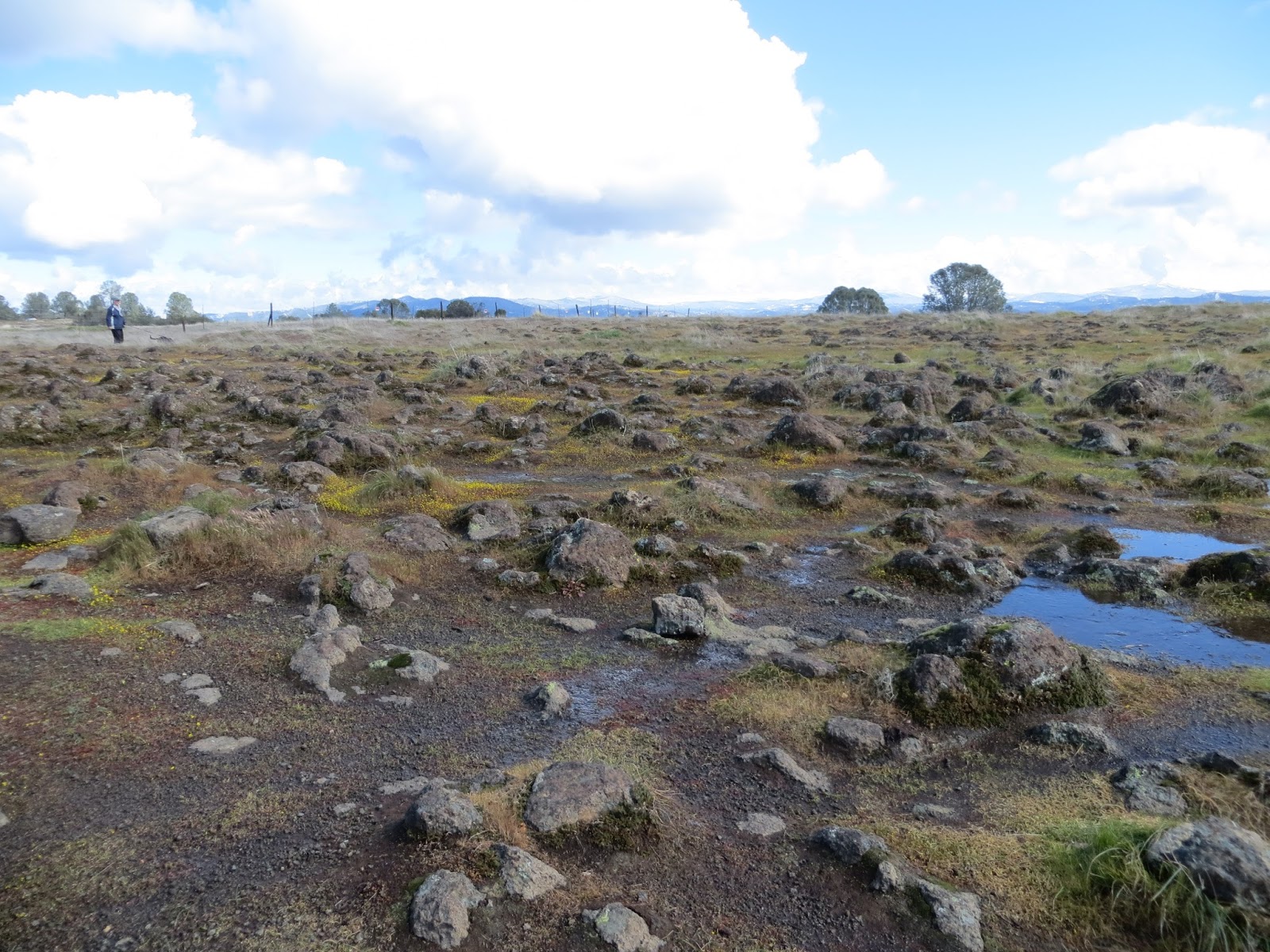
Any elevation above 2000’ woke up to snow the morning of our hike to Table Mountain in Jamestown. Though he had to dig out at home, Ranger Mike McGraw and two other Bureau of Reclamation rangers met us at the Shell Road trailhead. As 15 hikers gathered in the cold sun, it was apparent we’d lucked into a lengthy break in the late winter storm.
Table Mountain is a moderate, low-elevation hike that’s
accessible year-round. It’s only a
3-mile round trip and makes a nice “quickie” outing if you’re strapped for
time. You may extend your hike via
trails that link Table Mountain with the Peoria area or by heading down to the
lake via a spur off the main approach trail.
From the parking area to the mountain-top, there is private property all
around. Please respect the neighborhood
and boundaries. There are no services
other than the pit toilet; bring water!
Here's a map of the Table Mountain trail:
Here's a map of all the trails at New Melones Lake:
Saturday, March 3, 2018
TCT #3 -- Table Mountain, Jamestown
TCT #3 -- An astounding crowd of 50-70 turned up for the Red Hills hike on Feb. 3, which was warm and sunny. After a brief orientation by Patrick Congdon, a volunteer ranger with the Bureau of Land Management, we set out. The large group coalesced into smaller parties each "hiking their own hike" and enjoying the fine day. We had one report of a fox sighting! Leslie Smith provides an update on the Dragoon Gulch Hike and Run coming up on 2/25. Finally, from Bureau of Reclamation Ranger Mike McGraw, we learn about vernal pools, mastiff bats, and the oak woodlands of Table Mountain, our March 3 hike location.
Sunday, February 4, 2018
Trip Report - Red Hills ACEC, 2/3/18

Hike day dawned unseasonably warm for early February. The beautiful weather brought out a mob of
50-70 hikers to the trailhead! After a
brief orientation by Bureau of Land Management volunteer ranger Patrick
Congdon, the crowd quickly separated into more intimate clumps of 5-10 hikers
and dispersed along the trail. We were a
little early for the Red Hills’ claim-to-fame, the wildflowers. Instead we appreciated the geologic features (serpentine
rock, ultramafic soils, etc.) and plants which have adapted to this
nutrient-deficient environment (Foothills pine, Buckbrush, etc). While each group mayhave taken a slightly
different route with varying hike lengths, we all started at the North
Serpentine Road trailhead and walked along Horton Creek for a time. Some traversed the hills to South Serpentine
Road and looped back up to the starting point.
Some lingered on the Nature Trail studying the panels. Some saw a fox!Saturday, February 3, 2018
TCT #2 -- Red Hills ACEC, Chinese Camp
Here's episode 2 of Tuolumne County Trailhead. The first Saturday of 2018 was rainy, but it didn't throw a wet blanket on the enthusiasm of 19 Trail Heads who walked the full 6 miles of Tuolumne's West Side Trail. We were treated to glistening, pearl-like water drops adorning red berries, hidden "historic" stencils, lots of rail, misty mountains, and friendly camaraderie. Hike for a cause -- we meet with Leslie Smith the organizer of the upcoming (2/25/18) "Dragoon Gulch Hike and Run" fundraiser for Sonora's iconic trail system. Finally, February takes us to the Red Hills Area of Critical Environmental Concern in Chinese Camp. Patrick Congdon, a volunteer ranger with the Bureau of Land Management, and Glen White, geologist and educator, share what's significant about this special landscape.
Sunday, January 7, 2018
Trip Report - West Side Trail, 1/6/18
True to their new year’s resolutions or simply true outdoors-lovers, 19 Trail Heads convened on a rainy morning to walk the full 6-miles of the West Side Trail near Tuolumne. A few friends set out early to leave cars at trail’s end. It sprinkled most of the time we were out and poured by the time we were loading up in the cars to return to the trailhead. Along the way we were treated to views of the moody, misty mountains of the North Fork Tuolumne River canyon. We took time to treasure brush and berries glistening gem-like with raindrops. We dodged dismantled railroad track and ties.
Here's a link to the Tuolumne County Transit Council's West Side Trail page:
https://www.tuolumnecountytransit.com/single-post/2016/03/29/Westside-Railroad-Trail
Here's a link to Patricia Harrelson's article in the "Sierra Lodestar" about the first TCT hike of 2018:
http://www.calaverasenterprise.com/sierra_lodestar/article_95d52916-fbde-11e7-b96b-834613bb570c.html
Here's a link to Patricia Harrelson's article in the "Sierra Lodestar" about the first TCT hike of 2018:
http://www.calaverasenterprise.com/sierra_lodestar/article_95d52916-fbde-11e7-b96b-834613bb570c.html
Saturday, January 6, 2018
TCT #1 -- West Side Trail, Tuolumne
The first episode of Tuolumne County Trailhead ran in December. It introduced me, Wendy, your "hiking enabler," and the concept of the monthly hikes on first Saturdays in 2018. Peter Wisniewski, Stanislaus National Forest Archaeologist, discussed the West Side Trail in Tuolumne, our first hike. The West Side Trail is a rails-to-trails conversion with a gentle grade originally intended for logging trains. It's about 6 miles long and is accessible year-round, though it's a must-do hike in the spring for its profusion of wildflowers, especially the pungent Bush Lupine.
Monday, January 1, 2018
Hello, Trail Heads!
Welcome to the Tuolumne County Trailhead blog! The blog is a companion to the Tuolumne County Trailhead radio program on Sonora CA's community radio station, KAAD-LP 103.5 FM which streams at kaad-lp.org (link via "Links We Love" to the right). The show is on 2nd & 4th Sundays at 12:30pm, and the hikes are on 1st Saturdays. I'm your host Wendy Hesse. While I like talking about hiking, I really like actually hiking. The talking portion of TCT features soundbite reviews from Trail Heads on the previous hike and an interview with someone knowledgeable about the history and/or natural features of the upcoming hike. Rangers or other experts will be joining us on the trail to offer interpretation or other real-time observations. Give us a listen then ... "meet us at the trailhead!"
Subscribe to:
Posts (Atom)