Friday, August 24, 2018

September 1 -- Hike to Pinecrest Peak

When you plan a year in advance, you've gotta be ready for contingencies.  We are learning this in a big way this summer as our second hike in a row is being rerouted due to fire.  For our September 1 hike we were planning on heading up Clark Fork Rd. and taking the Disaster Creek trail into the Carson-Iceberg Wilderness up to the Pacific Crest Trail.  The Donnell Fire has changed all that.  We're relieved Highway 108 is open again to through traffic and that Kennedy Meadows is open for business.  We're heartbroken over the losses at Dardanelles and the vacation cabins.  We're ecstatic that beloved Baker Station and the Bennett Juniper were protected by brave, selfless fire fighters.  Thank you, thank you, thank you ALL who worked to keep us safe and informed!

For our September 1 hike, we'll be going up Pinecrest Peak for a different perspective on Pinecrest
Lake and Cleo's Bath (our October hike destination).  The rewards of this strenuous 6-mile trip include expansive vistas, gnarled trees, foundation remnants of a long-gone fire lookout, curious glacial erratics and curiouser stacked granite "pancake" boulders.

RSVP via email at the kaad-lp.org webpage or through the Tuolumne County Trailhead Facebook group.


TCT #9 -- Disaster Creek, Clark Fork Area


By the time episode 9 aired for the first time on 8/12/18, it became apparent that the Clark Fork Area, closed due to the Donnell Fire, would still be off limits for our Disaster Creek hike scheduled for September 1.  Instead, we'll hike to Pinecrest Peak (trailhead off of Herring Creek Rd.) for spectacular views down to Cleo's Bath (our October hike destination) and Pinecrest Lake.

TCT #9 features an interview with Rebecca Andrade, president of the Stanislaus Wilderness Volunteers.  Rebecca is a true Leave No Trace evangelist and shares how YOU can start making a difference now.  She also discusses the partnership between SWV and the Forest Service, trail maintenance and improvements, the 1964 Wilderness Act, the different focuses of Leave No Trace, and free LNT trainings available to members of the Stanislaus Wilderness Volunteers.  We talk a bit about the Bidwell-Bartleson party,
the first overland emigrants to California.  They chose to enter via the perilous West Walker Route and got lost in the rugged mountains and hills of Tuolumne, Alpine, and Calaveras counties roaming along what's now Clark Fork Rd., up to Big Trees, and into Sonora.  Finally, on Nov. 4, 1841, "destitute and almost naked," they arrived at Marsh's rancho at the base of Mt. Diablo.

The episode also includes Trail Heads' audio reviews of the Cooper Meadow hike, our Plan B instead of Wapama Falls (inaccessible due to closure of Hetch Hetchy and Yosemite Valley due to the Ferguson Fire.

Enjoy the show and be sure to take the Disaster Creek hike on your own one day after the area has recovered from the fire.


Sunday, August 19, 2018

Trip Report - Cooper Meadow, 8/4/18


Meadows and lakes abound on this trail


Oh, my.  What a fire season this summer.  The Carr Fire and the Mendocino Complex in Northern California; the Ferguson Fire persisting in Yosemite, all deadly and awful.  Now the Donnell Fire up on Highway 108, horribly destructive but not deadly – so far.  Heartbreak over the loss at Dardanelles Resort.Hope, love, and admiration to the firefighters struggling to save themselves and beloved Baker Station, Kennedy Meadows, and other structures in the area.

Deterred by the Ferguson Fire, which closed Yosemite including Hetch Hetchy and nixed our planned hike to Wapama Falls, we chose Cooper Meadow as Plan B.  The previous two weeks had been a bleak approximation of nuclear winter, and hike morning was dingy with smoke again.  A new fire, named the Donnell Fire, had started a day or two before.  As it was small (about 500 acres) and well east of our destination, we didn’t feel silly hoping for clear skies, or thinner smoke at least, at the 8,000’ trailhead.

When you see this pond, you're
almost there -- just downhill on
loose dirt then a short walk
through the forest to the meadow
Lunch break in the meadow


Most scenic view you ever
had from an outhouse!
And were we rewarded!  Blue skies! Deep green trees!  Bright green, grassy meadows!  Wildflowers of all colors!  Red volcanic outcroppings to the north and grey granite mountains to the south!  We had a short, steep-ish uphill section to a long hilly section shaded by tall pines opening up to expansive views as we passed several meadows, ponds, and traversed a hillside.  There was a final downhill scramble before we walked out to Cooper Meadow and its historic ranch buildings.  W.F. Cooper began grazing cattle here in 1861.  In 1912, the Cooper Meadow grazing allotment ceded to the Sanguinettis.  They still use it, and there was evidence of habitation as we approached – dogs, a tethered horse, an
Castle Peak and the Three Chimneys

exterior bathroom sink setup, a new padlock on the “house.”  The ranch buildings date from the 1860s and were entered into the National Register of Historic Places in 2009.  The real “eye candy” is the close-up view of our iconic Castle Rock and the Three Chimneys formation.  We picnicked on gigantic rocks in the meadow and explored streams that form the headwaters of the South Fork Stanislaus River.  Then it was time to return to the trailhead heading back out the way we came in – again with a tough uphill section, but this time after a good rest with good friends in a gorgeous setting.

Cooper Meadows is about a 7-mile round trip hike accessed from the Coyote Meadow Trailhead, off of Herring Creek Rd., east of Strawberry.  To get to the trailhead, take Highway 108 east past Strawberry; turn RIGHT on Herring Creek Rd and SET YOUR ODOMETER.  Herring Creek Rd. becomes 4N12 at 4.5 miles and becomes dirt at 5.5 miles then hits a "T" at 6.8 miles.  At the T turn RIGHT and go about .1 mile to a "Y" and stay RIGHT on 4N12.  At about 9.5 miles veer LEFT to stay on 4N12 (DO NOT go right onto 5N31).  At 11.3 miles turn RIGHT on 5N67 for about .6 mile.  Turn LEFT and park when you see the "Coyote Meadow Horse Camp" sign (12.3 miles from Highway 108).  Google Maps can take you there; get directions to Coyote Meadows, CA  95364.  Use a paper map and these written directions as a back-up!  The road is rough with some deep holes; be sure to drive something with decent clearance such as a Subaru Outback or an SUV or truck (NOT a Honda Civic!).

Here are a couple of links to interesting Tuolumne County Historical Society website pages.  One has a neat old photo of horses and riders at Cooper Meadow http://tchistory.pastperfectonline.com/photo/793D8C3A-D697-4AB9-B6B9-170441802630
and our local heritage sites on the National Register of Historical Places http://www.tchistory.org/TCHISTORY/Register.htm

Happy Trail Heads at hike's end


Monday, August 6, 2018

Trip Report – Wapama Falls, 8/4/18, CANCELLED due to fire


Due to the Ferguson Fire, the 8/4/18 hike destination was changed to Cooper Meadow.  We hope to do this hike later in the year as a “bonus.”  For now, hope for the safety and success firefighters and donate to relief efforts of the American Red Cross, Lions Club, or other worthy organizations.

Friday, August 3, 2018

8/3/18 -- Fact Finding Mission to Coyote Meadows TH


8/3/18 -- Took a drive to scope out the route to the Coyote Meadows Trailhead which we'll use for tomorrow's hike to Cooper Meadow.  The dirt section of the road is DEFINITELY HIGH-CLEARANCE REQUIRED!  The directions and mileages in the post about the hike are all good.  Only thing to bear in mind is when you get to the Trail of the Gargoyles/Herring Reservoir Campground area, it becomes minorly confusing.  Just stay right through this little jog in the road and continue with the directions as written.  If you're a GPS user, the trailhead coordinates are N 38,14.429' W 119,52.776'.
Well-marked turn onto 5N67

Coyote Meadows Trailhead

We left Sonora in what looked like a nuclear winter.  The smoke thinned as we gained elevation (and that you do, for sure; at the intersection of Hwy 108/Herring Creek Rd, it's about 6000' and at the trailhead it's 8405').  It was pretty at the trailhead, and the doggos had a fun, short run.

Happy dogs on pretty trail
See you tomorrow, I hope!

Thursday, August 2, 2018

Aug. 4, 2018 hike to Cooper Meadow (NOT Wapama Falls)


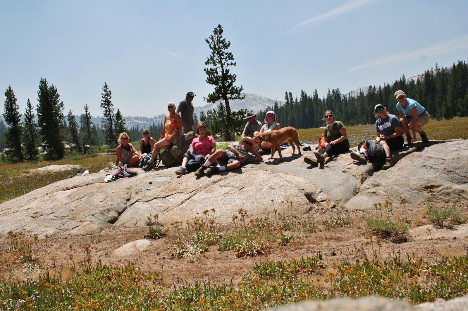
Historic ranch outbuilding and implements
 at Cooper Meadow


As you know, Yosemite, including Hetch Hetchy -- where we were supposed to hike on Saturday -- has been closed due to the Ferguson Fire.  We have a Plan B, though:  Cooper Meadow, east of Pinecrest.  I chose Cooper Meadow because the difficulty and distance is similar to what we expected for the Wapama Falls trail.  With just about a 500’ elevation increase, it’s fairly level.  While Wapama is moderately-easy, Cooper Meadow is definitely moderate due to elevation (around 8400’) and distance (7.25miles).  As far as the smoke goes, we’ll just have to hope for the best.


Castle Peak & the Three Chimneys from
Cooper Meadow
If you have respiratory issues, please stay home on Saturday!  I hope you can join us, though, because I think you’ll fall in love with this trail.  We’ll walk through evergreen forest with stands of aspen (come back for the fall color) and a few minor stream crossings (these feed the South Fork Stanislaus headwaters).  We’ll skirt Horse and Cow Meadow where the vista opens up to the familiar but always stunning volcanic formations: Three Chimneys, Castle Rock, Eagle Peak.  At our destination, historic ranch buildings dating from the 1870s are nestled in vast, mountain-ringed Cooper Meadow (maybe green and flower-filled).


Bring insect repellant (“meadow” means “mosquitoes maybe”).  Wear a hat, sunscreen and layers.  Bring water and snacks/lunch.  On-leash dogs are welcome.  We should be back to Sonora by 5.

The trailhead for this hike is only about 50 miles from Sonora, but the last third is on unpaved forest roads.  Those without high-clearance vehicles are encouraged to ride-share.


Carpool/caravan info:

1st stop/meeting point: Starbuck’s at the Junction in Sonora; meet at 7:45am; leave at 8am

2nd stop/meeting point: Mi-Wok Ranger Station, Me Wuk Village; meet at 8:15; leave at 8:30

Or meet at the trailhead at 9:30am:  Coyote Meadows/Coyote Meadow Horse Camp Trailhead.  Take Highway 108 east past Strawberry; turn RIGHT on Herring Creek Rd and SET YOUR ODOMETER.  Herring Creek Rd. becomes 4N12 at 4.5 miles and becomes dirt at 5.5 miles then hits a “T” at 6.8 miles.  At the T turn RIGHT and go about .1 mile to a “Y” and stay RIGHT on 4N12.  At about 9.5 miles veer LEFT to stay on 4N12 (DO NOT go right onto 5N31).  At 11.3 miles turn RIGHT on 5N67 for about .6 mile.  Turn LEFT and park when you see the “Coyote Meadow Horse Camp” sign (12.3 miles from Highway 108).  Google Maps can take you there; get directions to Coyote Meadows, CA 95364.  Use a paper map and these written directions as a back-up!