 |
| Columbia College campus trails - don't walk un-signed trails alone! |
Over the last few months, we've been steering you to events at Columbia College (Bat Night, Madagascar). Besides a revolving calendar of fun programs to engage your intellect, Columbia always has a variety of recreational venues available to you anytime any day: The Labyrinth for rock climbers, the Fitness Trail/Par Course which circumnavigates the campus and follows the Gold Rush-era ditch, and the Arboretum Nature Trail which showcases rock formations and native plants. In this episode, we talk to professors Tom Hofstra and Jeff Tolhurst about the trails at Columbia College. The Arboretum Nature Walk handout is available in our "Pages" section. We also talk to Columbia College physics professor Anca Husher about another alluring event: Starry Nights Moon Gazing on November 22 at 4:30pm at the college's astronomical observatory.
Our next hike will be on Saturday, December 7, 2019. We are going to Don Pedro Lake to walk the Shoreline Trail out of the Blue Oaks Group Area. This is a little less than 6 miles. We'll be walking above the high water level of the lake; there will be ups and downs, but no appreciable elevation gain. If the visibility is good, we have a chance of seeing some high Yosemite peaks such Mt. Lyell. We'll probably see a variety of waterfowl including Great Blue Herons. Bald Eagles, Ospreys, and Red-tail Hawks like the area, too. Dogs aren't allowed on Don Pedro trails, and there's a $10/car parking fee. We're excited that Seth Connolly, our friend from Tuolumne River Trust, will join us on the hike!
Here's a link to the Don Pedro Recreation Area Shoreline Trail brochure:
https://www.donpedrolake.com/sites/default/files/2016%20trail%20brochure%20web%20version.pdf
As usual, our radio show includes our "Three T" audio trip reports from the trail. Listen as the Trail Heads share what was trippy, tough, and tremendous about our outing along the Middle Fork Stanislaus River from Sand Bar Flat to Spring Gap. The easy-to-moderate 7-mile hike is a riot of color in the fall as the deciduous trees drop their leaves. The adventurous aspect of this hike was the drive to the trailhead, over 10 miles on a warren of unpaved, 4WD, high-clearance-required forest roads. Put "Sand Bar Flat Dam" (or GPS coordinates 38.1844, -120.1565) into your navigation, and you'll get there. Basically, though, you take Highway 108 east toward Cold Springs, Turn left on Fraser Flat Road. It will be 45 minutes to the destination from here. Cross the bridge and pass the campground. Then the pavement ends and you'll take the following forest roads: 4N42, 4N01, 4N88, and finally 4N85. Please review the route on a map before and as you travel! Here are some photos from our fun outing:
 |
Connie, Deverie, Brian, Dexter, Gay, Robert, Steve, Gary, Katie,
Sue, Ruben, Brett & Mike
|
 |
| For scale: the boots are size 9.5! |
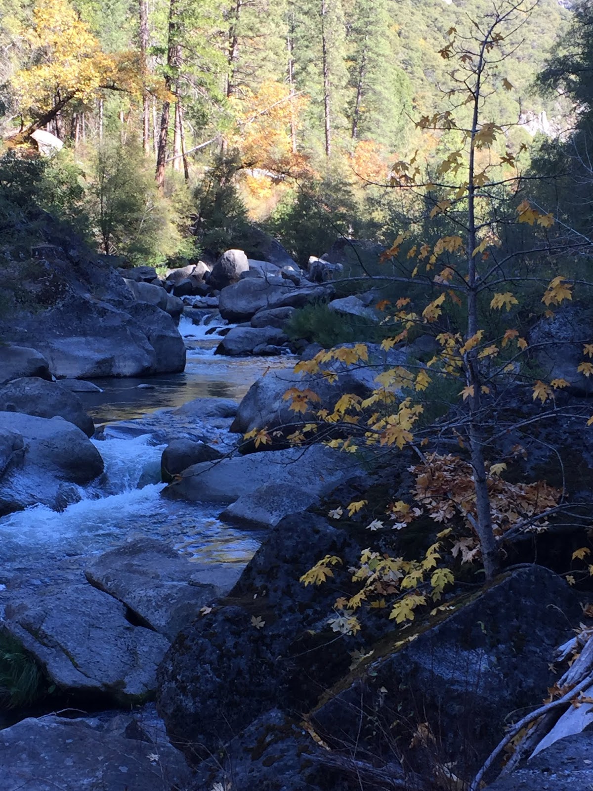 |
| Middle Fork Stanislaus River |
 |
Deverie and the
"Dalmatian Tree"
|
 |
| Ruben made a flute! |
 |
Dexter and Gay
|
Here's a link to the program, TCT #24 -- Columbia College:
https://drive.google.com/file/d/1nzYMtoLDW8lNNC2TqXCLvZbV7CJS93PT/view?usp=sharing