Friday, July 9, 2021

TCT #44 -- Lisa Mayo

Lisa Mayo
I had to do a double-take when I learned of ANOTHER "Trail Heads" program in Tuolumne County.  I learned it was a project of Visit Tuolumne County, our tourism bureau, intended to encourage visitors and residents alike to get out on our trails.  Of course, I had to learn more!  Lisa Mayo, the President and CEO of Visit Tuolumne County, was happy to oblige.  She's the subject of this month's interview.  We discuss the program, the initial dozen trails, the incentives and bonuses (badges and frames for your social network), hiking responsibly, sharing the trail, leave no trace, plans to add more trails according to seasons or attractions, and more!  Lisa is a livelong Tuolumne County resident and loves our trails and natural beauty.  She and I had a BLAST talking about hiking, as you can tell.  So give a listen then go to Visit Tuolumne County's website and explore their recommended hikes, record the hikes you've taken, and claim (and display!) your badges!

Not to show off,
but I got one of these!
Here is a link to the July 2021 Tuolumne County Trailhead radio show, TCT #44 -- Lisa Mayo:

https://drive.google.com/file/d/1SMpWRXQPf4iS0cDTnvcrzom2Fqflk2rM/view?usp=sharing

Here is a link to Visit Tuolumne County's "Trailheads" hiking challenge: https://www.visittuolumne.com/hiking-biking-trails

And here is a link to the flyer of the first dozen of Visit Tuolumne County's recommended hikes:  https://www.visittuolumne.com/vtc_trail_heads-map.pdf

Ya know, with every 1,000' of elevation gain on a clear day, you may subtract about 5 degrees in temperature.  Our hike recommendations this month are all at a minimum of 7,000', so while the lowlanders in Sonora (at about 2,000') are baking, you can be chilling in the mid 70's!  All three hikes are along Herring Creek Road (also known as Forest Road 4N12), about 2.5 miles east of Strawberrry.

Trail of the Gargoyles in the snow;
see what I mean about the precipitous rim?!?
Easy:  Trail of the Gargoyles -- take this interpretive trail, and you can check off one of the Visit
Tuolumne Trailheads hikes.  There are two trails -- the easier Trail of the Gargoyles, https://www.alltrails.com/explore/trail/us/california/trail-of-the-gargoyles-hike and the slightly more difficult Trail of the Gargoyles North Rim, https://www.alltrails.com/explore/trail/us/california/trail-of-the-gargoyles-north-rim  Features include such kid-pleasing names as "Wall of Noses," "Death Slide," and "Gargoyle Ridge."  Be careful along the precipitous rim of the formation. On your way, stop off at the Summit Ranger Station at Pinecrest on your way to pick up an interpretive guide.

Pretty Herring Creek

Moderate:  Just a short way from the Gargoyles is the lovely Herring Creek Trail.  This is a fairly easy hike but moderate due to the length -- a total of 7 miles.  But those miles are green and shady with a stop by the reservoir then a walk along the creek.  Go 3.5 miles then turn around at the prominent "Main Trail" sign, and retrace your steps back to the trailhead.  The trailhead is in the Herring Creek Reservoir Campground.  The campground is currently closed; you may park outside then walk in.  The trailhead begins at the end of the campground road.  This hike isn't in AllTrails, so here's a link to the campground's webpage with directions:  https://www.fs.usda.gov/recarea/stanislaus/recreation/camping-cabins/recarea/?recid=15035&actid=29

Challenging:  Pinecrest Peak, 8,445', will cool you down -- AFTER it wipes you out, haha! 

Near the Pinecrest Peak summit

To get to the trailhead, take Herring Creek Road for about 2.8 miles then turn right on Forest Road 4N27 (watch for the "Message Board" sign); drive to the end of the road.  The trail starts on the other side of the bride over Herring Creek.  There aren't many signs on the way up, but they're there when you need 'em!  Here's the AllTrails skinny on the trail:  https://www.alltrails.com/explore/trail/us/california/pinecrest-peak and also our own trip report of our 9/1/18 hike up Pinecrest Peak: https://tctrailhead.blogspot.com/2018/09/trip-report-pinecrest-peak-9118.html

Tuesday, June 8, 2021

TCT #43 -- Jason Torlano


Jason Torlano
In a "Christmas in July" vein, we offer a winter in the heat of summer retrospective with this month's TCT interview.  Our subject: Jason Torlano who, with Zach Milligan, did the first complete ski descent of Half Dome on 2/21/21.  Jason grew up in Yosemite and learned to ski at Badger Pass.  As an adventurous youngster in the park, he acquired some legendary rock climbing and ski-mountaineering mentors and honed his winter adventuring skills.  Jason is credited with over 20 first ski descents in Yosemite National Park including many from the points off of Glacier Point Road.  Jason also discusses his experiences in the Army, as a contractor in the Middle East, and setting ropes for high access work on wind turbines.  We also learn about what's closest to his heart: his family (wife and four kids) and his work in Syria and Myanmar with the humanitarian organization, Free Burma Rangers.

Here's a link to the radio program with the Jason Torlano interview:  https://drive.google.com/file/d/1yEbMpY_Lx29vsvWHlcy83YpfujxO7STR/view?usp=sharing

Here's a link to the Free Burma Rangers webpage: https://www.freeburmarangers.org/


Interpretive panel at Glacier Point -
Nevada Falls in center


To offer a sense of the scale and scope of Jason's first descents in Yosemite, this month's hike suggestions are all along Glacier Point Road.  For the easy hike, about a half a mile, drive out to the end of Glacier Point Road and walk the loop at the Glacier Point Overlook.  There you'll take in the grand vista of Half Dome, Clouds Rest, parts of Yosemite Valley, up the Mist Trail to Vernal and Nevada Falls, and out to the rugged peaks in the east.  See this link for details and directions:  https://www.alltrails.com/explore/trail/us/california/glacier-point-trail

Taft Point guard rail -- Yosemite Falls to mid-left
For a medium route, first you should drive to Glacier Point and walk that loop then hop in your car and
double back to the Sentinel Dome Trailhead for a 5.3 mile loop that takes you out to Sentinel Dome for great views to the north including stunning Yosemite Falls, then down the Pohono Trail to Taft Point for even more views then a forested walk back to the trailhead.  See this link for details and directions:  https://www.alltrails.com/explore/trail/us/california/sentinel-dome-and-taft-point-loop

View from Dewey Point - 
Bridalveil Falls in center

The challenging hike is a full-day adventure with a lot of driving.  Get some friends and take two cars into the park.  Leave one car at Tunnel View, cram into the other car, and drive to Glacier Point.  Here you'll embark on the Pohono Trail for 14.5 miles back to Tunnel View where you'll cram into the car there and drive back to Glacier Point to pick up the other car.  The point-to-point hike will take about 10 hours including must-do spur jaunts out to Sentinel dome, Taft Point, Dewey Point, and Crocker Point, hiking, resting, photographing, and snacking.  Also for negotiating some downed trees requiring scrambling and some minor re-routing.  It's about a forty-five minute drive between Tunnel View and Glacier Point, so there will be a fair amount of time spent driving, too.  See this link for details and directions:  https://www.alltrails.com/explore/trail/us/california/pohono-trail-glacier-point-to-inspiration-point

Also to consider -- in 2022, Glacier Point Road will close for the entire year for road improvements and rehabilitation.  So, this is the year to get your Glacier on!

And remember -- you need a reservation to enter Yosemite National Park this summer.  Here is a link to the park's website with info:  https://www.nps.gov/yose/planyourvisit/reservations.htm

The links to the trail descriptions for this month's hikes are all from AllTrails, a hiking trails app with worldwide crowd-sourced trail reviews, photos, and resources.  AllTrails has both free and premium versions.  I use the free version for reference, ideas, and current trail conditions.  I understand the premium version offers tracking.  There are other similar services; for instance, I pay an annual fee for Gaia GPS and track my hikes there, which is a lot of fun!

Monday, May 10, 2021

TCT #42 -- Wesley Trimble & the AHS

Wesley Trimble via Zoom
One of the first resources I discovered when I undertook the Tuolumne County Trailhead project was the American Hiking Society.  The AHS has a number of initiatives including National Trails Day, Volunteer Vacations, Hike the Hill, and Alternative Break.  In our first two years, we participated in National Trails Day (the first Saturday in June), hosting two trail service projects -- picking up trash on trails at Fraser Flat and Pinecrest.  When Covid hit, I looked to AHS for guidance on how to safely get outdoors and continue hiking.  For May's radio show, I reached out to AHS for info about how they're handling this year's National Trails Day.  They put me together with their Communications and Creative Director, Wesley Trimble, a Colorado-based lifelong hiker who's passionate about public lands and trails.  Wesley and I talked about National Trails Day, hiking responsibly, and some of Wesley's personal projects -- among them, he's summitted all of Colorado's 14'ers!

Here's a link to the radio show TCT #42 - Wesley Trimble & the AHS:  https://drive.google.com/file/d/1TTtLAmKthbMoCguT-zhDy0EZKQRLIFBa/view?usp=sharing

And here are a bunch of links to sites Wesley and I discussed:

Wesley was featured in an in-depth interview on the Adventure Sports Podcast.  Give a listen:  https://www.adventuresportspodcast.com/2021/03/ep-709-embracing-weakness-in-mountains.html

In lieu of an in-person event for National Trails Day, TCT recommends donating to 3 Forests Interpretive Association (https://www.3forests.com/donate/).  We encourage you to designate your donation for the benefit of improvements to the "Shadow of the Mi-Wok Interpretive Trail" in the Stanislaus NF, Summit Ranger District.  (See our virtual event on the AHS's list of National Trails Day activities: https://americanhiking.org/national-trails-day/find-an-event/#search-virtual-events/view-event-details15/60a5698929d40f0020cf25ff/.)

This month we're observing a couple of seasonal occasions:  The Opening of the Pass and the Blooming of the Dogwoods.  When the pass opens, my husband and I trek over to the East Side to observe the snow level and to reward ourselves with a meal in Walker.  However, this is a "flat-butt"-inducing amount of time to spend in the car.  Break it up by stopping off for easy walks at any of these short nature trails along the way: 

Just as you turn off Highway 108 to go to Pinecrest, on the right is the quarter-mile Shadow of the Mi-Wok Interpretive Trail.  Here's a link to the trail's webpage with info and GPS coordinates:  https://www.fs.usda.gov/recarea/stanislaus/recreation/hiking/recarea/?recid=15081&actid=50

Archaeologist Shelly Davis-King
at a replica Mi-Wok shelter
November 2018

The Donnell Vista is further up Highway 108, between Eagle Meadow Road and Clark Fork Road.  A left turn off the highway, it offers a sweeping view of the Stanislaus River canyon, the Dardanelle Cones, and Donnell Reservoir.  Here's a link to the vista's webpage and GPS coordinates:  https://www.fs.usda.gov/recarea/stanislaus/recreation/hiking/recarea/?recid=15073&actid=50

Donnell Vista -
Accessible Nature Trail!

The last of the three short "stretch your legs" options when taking the long drive over the pass is the Columns of the Giants, a mini-Devil's Postpile, is almost to Kennedy Meadows, at Pigeon Flat, to the right off the highway.  Here's a link to the geological site's webpage and GPS coordinates: https://www.fs.usda.gov/recarea/stanislaus/recreation/hiking/recarea/?recid=15071&actid=50


Columns of the Giants, summer 2020


The dogwoods are in bloom, and you can see them on many of our forest trails.  They put on a real show on the Sugar Pine Railway, Twain Harte Branch.  This rails-to-trails conversion runs five miles between Confidence and Lyons Lake.  For a medium outing, walk about 2.5 miles in (then out -- 5 miles, duh!).  If you want more of a challenge, walk the entire route both ways for a double-digit accomplishment!  Here's a link to the interpretive brochure for the trail with directions to the trailhead and more: https://www.tuolumnecountytransportationcouncil.org/single-post/2016/08/10/Lyons-to-Twain-Harte


Dogwood along the Sugar Pine Railway,
Twain Harte Branch, May 2020
Note the metal walkway on the
flume below!


Thursday, April 8, 2021

TCT #41 -- Kevin Gong

Kevin at Channel Islands NP

I was head-over-heels to be able to interview my hiking hero, Kevin Gong!  Kevin is based in San Mateo County and since 1995 has been keeping a superb webpage documenting his hikes.  I don't remember when I discovered the site, but I've been referring to it ever since, especially for out-of-area hikes.  Kevin has organized this journal very well with statistics, photos, maps, and narrative all sorted into various categories such as region, month, rating, and more.  Kevin is married and has two teenaged sons.  The Gong family has been hiking and backpacking together since the oldest boy was 2 months old.  They've even done the John Muir Trail (233 miles, when the kids were both pre-teens)! 
Kevin Gong

Kevin and I chatted by Zoom, and I think I held it together without too much hero-worship oozing into the interview!  Give a listen:

Here's a link to the radio show TCT #41 - Kevin Gong:  https://drive.google.com/file/d/1v6dfE9QPfGGXDIJL99jKNFyVgRQLgm-U/view?usp=sharing

Here's a link to Kevin's hiking page:  http://kevingong.com/Hiking/index.html

This month's recommended hikes are all Bay Area based, and you can read about them on Kevin's Hiking Page.


Coyote Hills, October 2015
For an easy saunter on the edge of San Francisco Bay, go to Coyote Hills Regional Park just north of Fremont.  There are numerous trails of varying length and difficulty.  If it's open, there's a wonderful visitor center with an adjacent nectar garden filled with gorgeous flowers to fortify visiting pollinators.  There are also Tuibun Ohlone shellmounds and a village which you may tour (reservations required).  This park is a favorite of birders, too, so bring your binoculars.  Here's a link to the park's brochure:  https://www.ebparks.org/Parks/Coyote_Hills/


Lake Chabot, July 2011
If you want a medium outing, go to Anthony Chabot Regional Park in Castro Valley and take the 8 mile walk around Lake Chabot.  Lake Chabot holds drinking water for East Bay communities, and to keep the supply safe, there are toilets spaced intermittently around the lake -- how convenient, unusual, and welcome!  Here's a link to the park's brochure:  https://www.ebparks.org/parks/anthony_chabot/


Mission Peak, May 2012
A challenge with a stunning pay off is to summit Mission Peak, at Mission Peak Regional Preserve in Fremont.  Get an early start and bring lots of water; you will gain 2,000' in elevation with very little shade.  Here's a link to the park's brochure:  https://www.ebparks.org/parks/mission/default.htm


Bring some money, as there are parking fees at the trailheads for each of these routes.


Finally -- cue the Hallelujah Chorus -- mark your calendar for Saturday, May 15!  Hopefully you meet the requirements and can join us on our "No Hugs Barred Hike - An Outing For Those 2 Weeks Past Their COVID Vaccination Series and Reward for a Year of Social Distancing."  Watch this space! 

Friday, March 12, 2021

TCT #40 -- West Side Trail Revisited

Ellen and Vonna on the West Side Trail, 3/2021
Our very first Tuolumne County Trailhead hike was in January 2018 on the West Side Trail in Tuolumne.  We woke to a cold, rainy morning and staged cars at the end and beginning of the 6-mile trail.  About 15 folks weren't scared off by the weather and walked the distance -- some carried a cake!  In the last season of the Tuolumne County Trailhead radio program, we have decided it's time to revisit the West Side Trail, one of the favorites in the county.  It's appropriate as the trail is seeing some improvements in its "gateway community," the Mira Monte subdivision.  Mira Monte has become the seventh Tuolumne County Fire Safe Community, and the adjacent West Side Trail is an indirect beneficiary of the shaded fire break being created there.  Stephen Johnson, a delightful, energetic, generous fellow, is the Project Director.  He and I met on the trail to discuss changes and improvements that will be visible -- and audible -- during the final year of the project, which ends in March 2022.  Give a listen:  https://drive.google.com/file/d/1SFB3PiY5V1JSJPFefYii9T3awhbz5tVe/view?usp=sharing

The Ponderosa-Mira Monte
Shaded Fuel Break
This month's hiking recommendations are all on the West Side Trail.  The trailhead is at the intersection of Buchanan and Mira Monte roads.  There is parking, but there are no services (IE:  no toilets or water), so come prepared. The trail is a former railroad grade and has minimal elevation gain.  For an easy stroll, walk a mile in to where the rails begin for a two mile round trip.  For a medium outing, ask a friend to join you and set up a car shuttle so you may walk the full 6-mile length of the trail.  Stage a car at the end of the trail -- the bridge at the confluence of the Tuolumne River and Basin Creek, just before River Ranch Campground.  Then you can drive back to the Mira Monte trailhead, park and walk to retrieve the other car.  For a difficult trek, walk the full length of the trails BOTH directions; this will give you a 12-mile achievement that you can brag about!

The West Side Trail is a 4-season route, but spring is "the best," as there are wildflowers galore, and the star of the show is the plentiful, huge, fragrant Bush Lupine, which should be blooming in early-to-mid April.  In the summer, it can be quite hot at midday on the exposed canyon slopes; it's best to go early or late.  It will be fun visiting the trail over the next year and watching the progress of the shaded fuel break.

Finally, please, please, please get your COVID-19 vaccination ASAP!  And please, please, please encourage your family, friends, neighbors, coworkers, and strangers on the street to get their vaccinations, too!  The end of the pandemic is in sight -- maybe we'll be having family barbecues on Independence Day!  We just need to get our shots AND protect those still waiting for theirs -- when out in public, continue to wear your mask, keep your distance, and sanitize.  Too many have paid too high a price; we can't let those sacrifices be in vain by messing up so close to the end!

RESOURCES for this month's radio program and suggested hikes:

Here's a link to the Tuolumne Fire Safe Council webpage:  https://tuolumnefiresafe.org/ 

Here's a link to the West Side Trail brochure:  https://docs.wixstatic.com/ugd/fe950e_913e3ebaeb864f2ea8e3246f283e4f4d.pdf

Check out our first three blog posts of 2018 for resources about the West Side Trail:

  • Saturday, 1/6/18 -- An interview with a Forest Service archaeologist about the natural and human history of the West Side Trail
  • Sunday, 1/7/18 -- A trip report narrative with photos
  • Saturday, 2/8/18 -- The first part of the radio show features real-time audio trip reports from folks who took the 1/6/18 hike

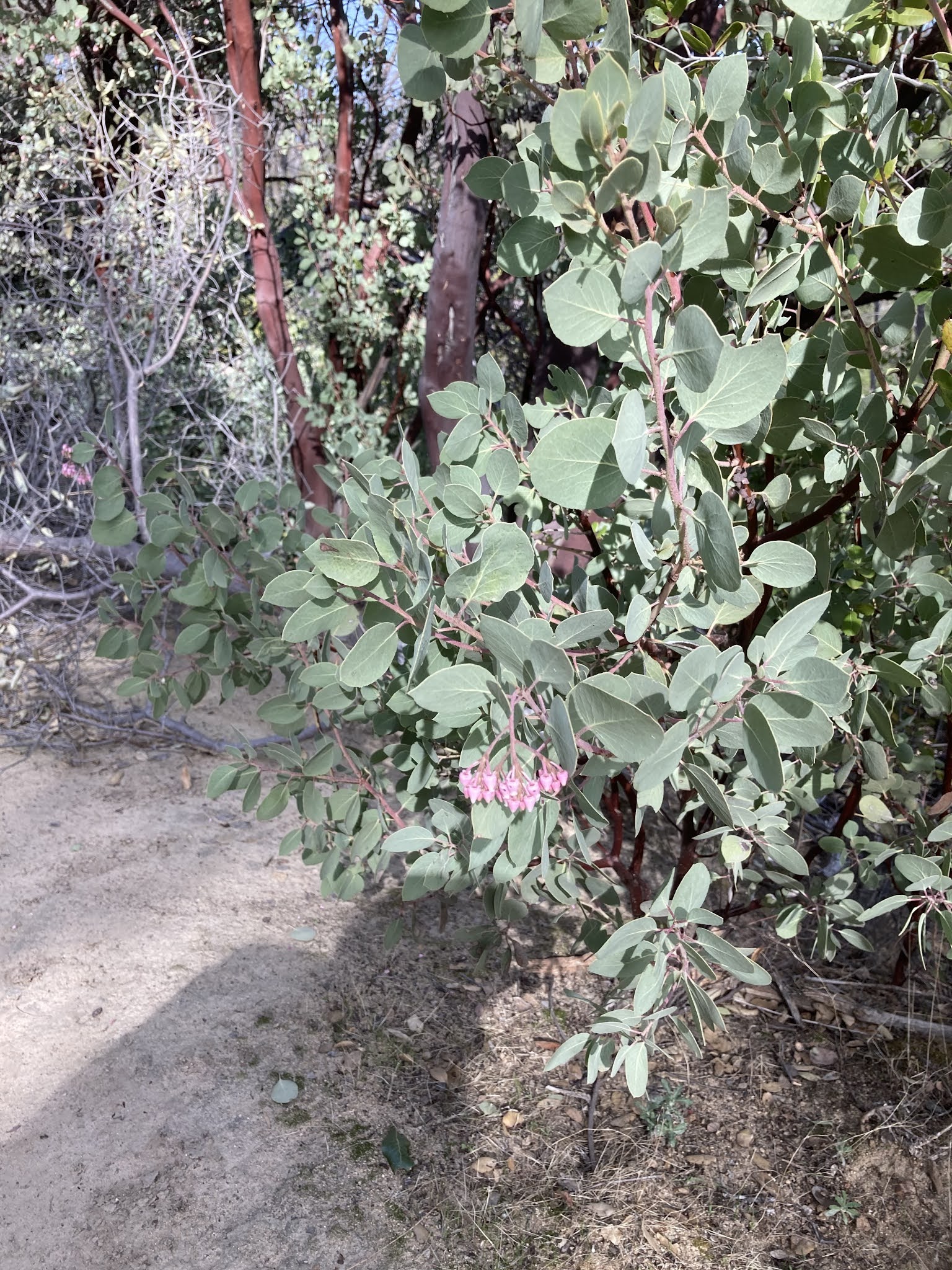
Manzanita in bloom,
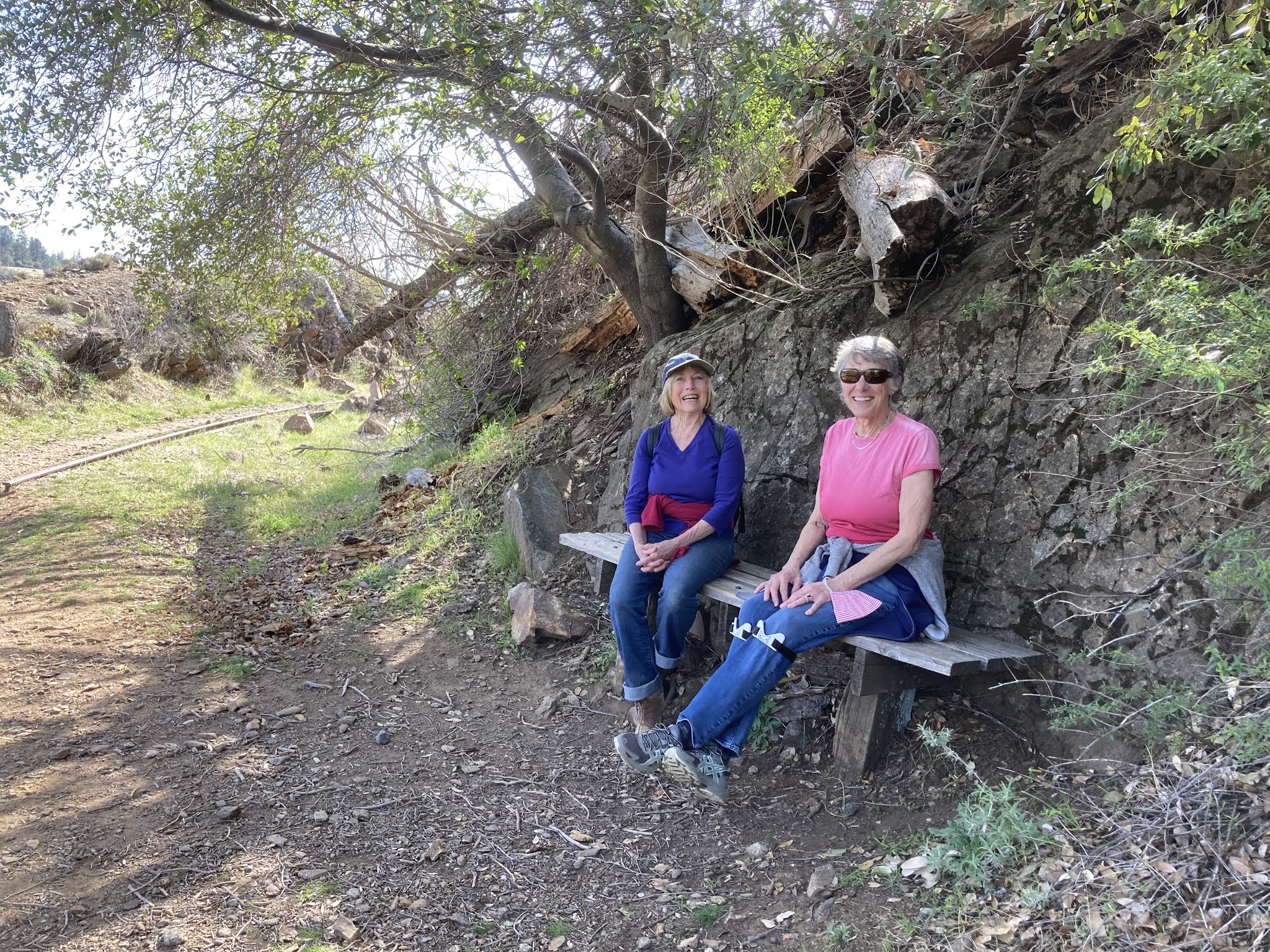
West Side Trail, 3/2021

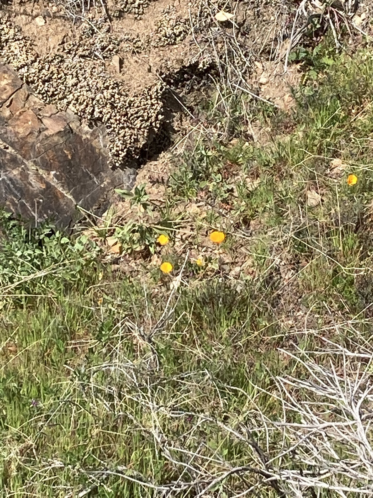
Poppies are starting to pop!
West Side Trail, 3/2021

Rails to trails!


New growth on the Buckeyes
West Side Trail, 3/2021


Yes, we ALL love the
West Side Trail

Thursday, February 11, 2021

TCT #39 -- "Campfire Stories"

Dave and Ilyssa Kyu saw a need and filled it.  They were new to camping and didn't have a repertoire of stories to tell around the camp fire.  Wanting more than ghost stories and fairy tales, they started looking for tales and accounts that captured the flavor of the area they were visiting.  As researchers, they knew they had to narrow their scope.  They settled on 41 stories, poems, songs, and excerpts from and about six national parks.  Stash this book in your gear and bring it along for evening entertainment on your next camping trip.  Or use it for reference for ideas on where to spend your next vacation.  Or keep it at hand for when you need a dose of lyrical literature -- there are pieces by Terry Tempest Williams and John Muir, always inspiring!

I interviewed Dave and Ilyssa at the end of December, and the conversation is the bulk of this month's radio show.  They revealed that there will be a "Campfire Stories, Volume II," and that they're seeking submissions.  You, talented Trail Head, might find your scribblings included, if you dare!

Setting out on the Merced Grove trail
This month's recommended outings:  Go snowshoeing!  Yosemite National Park's Crane Flat Winter Trails offer a variety of outings from easy snow play to snowshoeing and cross country skiing tracks with a wide range of challenge from "easiest" to "most difficult."  On Super Bowl Sunday we went snowshoeing at the Merced Grove (Giant Sequoias -- 3 miles round trip with a 500' elevation change, "most difficult") and Rockefeller Grove (Rim Fire Burn Area -- 4.5 miles round trip, "easiest").  For an easy outing, take either or both trails to the point where the grade starts; for a medium trip, do the full Rockefeller Grove trail; for a challenging trek, do both trails.  Don't forget -- Yosemite's daily reservation system started up again on 2/8/21; be sure to have your daily reservation before heading to the park!

Ann, Rick, & Jeanette


Robert & Gary at the
Merced Grove of Giant Sequoias


Sheri, Gary & Robert on the
Rockefeller Grove trail

The Three Chimneys from a viewpoint
just off the Rockefeller Grove trail


Listen to February 2021's Tuolumne County Trailhead radio show, TCT #39 -- Campfire Stories, here:  https://drive.google.com/file/d/1CgioLGYZKHK9iviBEpRLsC9sAVfeNYF4/view?usp=sharing

Here's a link to Dave & Ilyssa's "Campfire Stories" website:  https://www.campfirestoriesbook.com/  Details about writing submissions are under the "On The Road" menu heading.

Here's a link to Yosemite National Park's "Crane Flat Winter Trails" brochure:  https://www.nps.gov/yose/planyourvisit/upload/cflat-winter.pdf


Friday, January 8, 2021

TCT #38 -- Karen Bakerville Smith Memorial Trail, Columbia

Karen Bakerville Smith Memorial Trail

Happy New Year, Trail Heads!  In 2021, we're offering three hiking recommendations each month.  For those new to hiking or recovering from an injury or surgery or just wanting to ease into fulfilling a resolution, we'll have a suggestion for an easy stroll.  For experienced hikers wanting something to change-it-up a little, we'll have a moderate option.  For folks who are in shape and want to test themselves, we'll highlight a challenging trail.

This month, our easy option is the Karen Bakerville Smith Memorial Trail in Columbia State Historic Park.  I "discovered" this lovely one-half mile interpretive loop in October and have been back with family and friends several times.  I was excited to score a guided trip with Park Interpreter Kelly Leage.  Our stroll among the oaks is the feature of this month's radio show.  This is a short and sweet walk, appropriate for all ages and abilities.  Those less sure-footed may want to bring hiking poles for stability in wet conditions or at the one or two very short, steep-ish spots.  If a half-a-mile is too little for you, take the loop again.  You can also add distance by:

  • walking through the nearby Columbia Cemetery
  • continuing your walk down into Columbia State Historic Park's downtown section
  • after completing the KB Smith Memorial Trail, walk to south-east corner of the Columbia Elementary parking lot (.75 mile from the KB Smith Memorial Trail); look for the chuckle-inducing street sign "Airport Nature Trail" which is one end of the Frank Dondero Nature Trail; walk the Dondero Trail (a half-mile round trip); return to your vehicle at the KB Smith Memorial Trail.  This would give you a walk of about 3 miles.

The trailhead for the Karen Bakerville Smith Memorial Trail is at the Historic Columbia Schoolhouse at 22956 School House St., Columbia.  There's a parking area with a working bathroom.  Also, there are picnic tables at the trailhead.  There are benches along the trail and another picnic table at the "Poem Rock."
What's open/closed at Columbia SHP
during the COVID-19 pandemic

Our moderate hike is another one that is new to me:  The Tower

Tower Climb/Carson Creek Trail
Climb/Carson Creek Trail at New Melones Lake's Glory Hole Recreation Area near Angels Camp.  This 3.5 mile loop was enchanting on a rainy Saturday.  We had views of the lake; we saw oaks, woodpeckers, other hikers, other dogs, and mountain bikers.  Don't be intimidated by the "Climb" in the trail's name.  We thought we'd be wrecked, but it wasn't bad at all -- a 400' climb accomplished in about one mile.

The trailhead for the Tower Climb Trailhead is about a quarter mile inside the Glory Hole Recreation Area entrance kiosk.  Look for the parking area on your left.  There's also a vault toilet (clean & open!).  The trail starts at the south-east end of the parking area.  The trail goes downhill via switchbacks.  You may want to bring hiking poles.  At about 2.75 miles, the trail meets the Carson Creek Trailhead parking area (another vault toilet - clean & open).  Walk through the parking lot, cross Whittle/Glory Hole Road, then veer right toward the very apparent dirt access road heading "straight up."  This is your short, steep final push back to your vehicle.  You can shorten the distance and eliminate the uphill by staging cars at the Tower Climb Trailhead and the Carson Creek Trailhead.  There's an entry fee at Glory Hole Recreation Area (as well as at Tuttletown Recreation Area) which is covered if you display your America the Beautiful-National Parks and Federal Recreation Lands Annual Pass or Senior Lifetime Pass.

Middle Fork Stanislaus River
China Flat/Sand Bar Flat Trail

Finally, submitted for your approval, oh hiker seeking a challenge:  the Middle Fork Stanislaus River from China Flat Day Use Area to Sand Bar Flat Campground (and back) -- 13 miles.  This is one of my faves, and the "difficult hikers" and I walked about 10 miles of the route in early December.  It started out cool and crisp then became sunny and warm; and because it took most of the day, it became cool and crisp again!  This trail isn't particularly difficult; it's the length that offers the challenge.  But there are rewards galore on this gorgeous hike -- the river as constant companion; experiencing the slightly different ecozones walking first on the north side then crossing the bridge and walking the south side of the canyon; the chance of seeing eagles, ducks, American Dippers, river otters, and bears; mossy rocks; Big-Leaf Maples and other deciduous trees.  This is also an all-season hike, provided the road to Beardsley Lake is open.  Highway 108 is at about 6,000' elevation at the Beardsley Lake turnoff, but the elevation at the China Flat Day Use Area is just over 3,000', putting the trail itself below snow level most of the time.

The trailhead for this hike is at China Flat Day Use Area, at the base of Beardsley Dam, near Strawberry.  Take Beardsley Lake Road; descend to the dam and drive across; on the north side of the dam, make a sharp left.  Drive down the dam face to the China Flat Day Use Area and park here.  There are picnic tables and a vault toilet (open last time I was there).  Walk west down the dirt road along the north side of the river.  The road gradually narrows and the trail begins to the right of some large boulders.  At about 3 miles, you'll cross the south side of the river via a footbridge.  This is a good turn-around point if you want a shorter hike.  I highly recommend continuing 3.5 miles further to Sand Bar Flat Campground; the south side of the river is breathtakingly lush.


Listen to January 2021's Tuolumne County Trailhead radio show, TCT #38 -- Karen Bakerville Smith Trail, here:  https://drive.google.com/file/d/1JQm3ALWhWoxhEYTsICYybTNRpZbXm5Pc/view?usp=sharing

Here's a link to the park brochure for Columbia State Historic Park (KB Smith Trail apparent on the map on page 5): https://www.parks.ca.gov/pages/552/files/ColumbiaSHPFinalWeb2015.pdf

Here's a link to the Friends of Columbia State Historic Park: http://friendsofcolumbiashp.org/

Here's a link to a map of the hiking trails at Glory Hole Recreation Area (near Angels Camp), New Melones Lake:  https://www.usbr.gov/mp/ccao/newmelones/docs/maps/map-new-melones-lake-trail.pdf

Here's a link to the Stanislaus National Forest webpage for China Flat Day Use Area:  https://www.fs.usda.gov/recarea/stanislaus/recarea/?recid=77789