Thursday, April 8, 2021

TCT #41 -- Kevin Gong

Kevin at Channel Islands NP

I was head-over-heels to be able to interview my hiking hero, Kevin Gong!  Kevin is based in San Mateo County and since 1995 has been keeping a superb webpage documenting his hikes.  I don't remember when I discovered the site, but I've been referring to it ever since, especially for out-of-area hikes.  Kevin has organized this journal very well with statistics, photos, maps, and narrative all sorted into various categories such as region, month, rating, and more.  Kevin is married and has two teenaged sons.  The Gong family has been hiking and backpacking together since the oldest boy was 2 months old.  They've even done the John Muir Trail (233 miles, when the kids were both pre-teens)! 
Kevin Gong

Kevin and I chatted by Zoom, and I think I held it together without too much hero-worship oozing into the interview!  Give a listen:

Here's a link to the radio show TCT #41 - Kevin Gong:  https://drive.google.com/file/d/1v6dfE9QPfGGXDIJL99jKNFyVgRQLgm-U/view?usp=sharing

Here's a link to Kevin's hiking page:  http://kevingong.com/Hiking/index.html

This month's recommended hikes are all Bay Area based, and you can read about them on Kevin's Hiking Page.


Coyote Hills, October 2015
For an easy saunter on the edge of San Francisco Bay, go to Coyote Hills Regional Park just north of Fremont.  There are numerous trails of varying length and difficulty.  If it's open, there's a wonderful visitor center with an adjacent nectar garden filled with gorgeous flowers to fortify visiting pollinators.  There are also Tuibun Ohlone shellmounds and a village which you may tour (reservations required).  This park is a favorite of birders, too, so bring your binoculars.  Here's a link to the park's brochure:  https://www.ebparks.org/Parks/Coyote_Hills/


Lake Chabot, July 2011
If you want a medium outing, go to Anthony Chabot Regional Park in Castro Valley and take the 8 mile walk around Lake Chabot.  Lake Chabot holds drinking water for East Bay communities, and to keep the supply safe, there are toilets spaced intermittently around the lake -- how convenient, unusual, and welcome!  Here's a link to the park's brochure:  https://www.ebparks.org/parks/anthony_chabot/


Mission Peak, May 2012
A challenge with a stunning pay off is to summit Mission Peak, at Mission Peak Regional Preserve in Fremont.  Get an early start and bring lots of water; you will gain 2,000' in elevation with very little shade.  Here's a link to the park's brochure:  https://www.ebparks.org/parks/mission/default.htm


Bring some money, as there are parking fees at the trailheads for each of these routes.


Finally -- cue the Hallelujah Chorus -- mark your calendar for Saturday, May 15!  Hopefully you meet the requirements and can join us on our "No Hugs Barred Hike - An Outing For Those 2 Weeks Past Their COVID Vaccination Series and Reward for a Year of Social Distancing."  Watch this space! 

Friday, March 12, 2021

TCT #40 -- West Side Trail Revisited

Ellen and Vonna on the West Side Trail, 3/2021
Our very first Tuolumne County Trailhead hike was in January 2018 on the West Side Trail in Tuolumne.  We woke to a cold, rainy morning and staged cars at the end and beginning of the 6-mile trail.  About 15 folks weren't scared off by the weather and walked the distance -- some carried a cake!  In the last season of the Tuolumne County Trailhead radio program, we have decided it's time to revisit the West Side Trail, one of the favorites in the county.  It's appropriate as the trail is seeing some improvements in its "gateway community," the Mira Monte subdivision.  Mira Monte has become the seventh Tuolumne County Fire Safe Community, and the adjacent West Side Trail is an indirect beneficiary of the shaded fire break being created there.  Stephen Johnson, a delightful, energetic, generous fellow, is the Project Director.  He and I met on the trail to discuss changes and improvements that will be visible -- and audible -- during the final year of the project, which ends in March 2022.  Give a listen:  https://drive.google.com/file/d/1SFB3PiY5V1JSJPFefYii9T3awhbz5tVe/view?usp=sharing

The Ponderosa-Mira Monte
Shaded Fuel Break
This month's hiking recommendations are all on the West Side Trail.  The trailhead is at the intersection of Buchanan and Mira Monte roads.  There is parking, but there are no services (IE:  no toilets or water), so come prepared. The trail is a former railroad grade and has minimal elevation gain.  For an easy stroll, walk a mile in to where the rails begin for a two mile round trip.  For a medium outing, ask a friend to join you and set up a car shuttle so you may walk the full 6-mile length of the trail.  Stage a car at the end of the trail -- the bridge at the confluence of the Tuolumne River and Basin Creek, just before River Ranch Campground.  Then you can drive back to the Mira Monte trailhead, park and walk to retrieve the other car.  For a difficult trek, walk the full length of the trails BOTH directions; this will give you a 12-mile achievement that you can brag about!

The West Side Trail is a 4-season route, but spring is "the best," as there are wildflowers galore, and the star of the show is the plentiful, huge, fragrant Bush Lupine, which should be blooming in early-to-mid April.  In the summer, it can be quite hot at midday on the exposed canyon slopes; it's best to go early or late.  It will be fun visiting the trail over the next year and watching the progress of the shaded fuel break.

Finally, please, please, please get your COVID-19 vaccination ASAP!  And please, please, please encourage your family, friends, neighbors, coworkers, and strangers on the street to get their vaccinations, too!  The end of the pandemic is in sight -- maybe we'll be having family barbecues on Independence Day!  We just need to get our shots AND protect those still waiting for theirs -- when out in public, continue to wear your mask, keep your distance, and sanitize.  Too many have paid too high a price; we can't let those sacrifices be in vain by messing up so close to the end!

RESOURCES for this month's radio program and suggested hikes:

Here's a link to the Tuolumne Fire Safe Council webpage:  https://tuolumnefiresafe.org/ 

Here's a link to the West Side Trail brochure:  https://docs.wixstatic.com/ugd/fe950e_913e3ebaeb864f2ea8e3246f283e4f4d.pdf

Check out our first three blog posts of 2018 for resources about the West Side Trail:

  • Saturday, 1/6/18 -- An interview with a Forest Service archaeologist about the natural and human history of the West Side Trail
  • Sunday, 1/7/18 -- A trip report narrative with photos
  • Saturday, 2/8/18 -- The first part of the radio show features real-time audio trip reports from folks who took the 1/6/18 hike

Manzanita in bloom,
West Side Trail, 3/2021

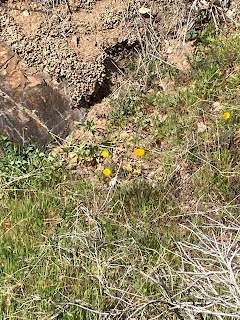
Poppies are starting to pop!
West Side Trail, 3/2021

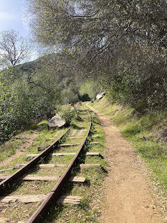
Rails to trails!


New growth on the Buckeyes
West Side Trail, 3/2021


Yes, we ALL love the
West Side Trail

Thursday, February 11, 2021

TCT #39 -- "Campfire Stories"

Dave and Ilyssa Kyu saw a need and filled it.  They were new to camping and didn't have a repertoire of stories to tell around the camp fire.  Wanting more than ghost stories and fairy tales, they started looking for tales and accounts that captured the flavor of the area they were visiting.  As researchers, they knew they had to narrow their scope.  They settled on 41 stories, poems, songs, and excerpts from and about six national parks.  Stash this book in your gear and bring it along for evening entertainment on your next camping trip.  Or use it for reference for ideas on where to spend your next vacation.  Or keep it at hand for when you need a dose of lyrical literature -- there are pieces by Terry Tempest Williams and John Muir, always inspiring!

I interviewed Dave and Ilyssa at the end of December, and the conversation is the bulk of this month's radio show.  They revealed that there will be a "Campfire Stories, Volume II," and that they're seeking submissions.  You, talented Trail Head, might find your scribblings included, if you dare!

Setting out on the Merced Grove trail
This month's recommended outings:  Go snowshoeing!  Yosemite National Park's Crane Flat Winter Trails offer a variety of outings from easy snow play to snowshoeing and cross country skiing tracks with a wide range of challenge from "easiest" to "most difficult."  On Super Bowl Sunday we went snowshoeing at the Merced Grove (Giant Sequoias -- 3 miles round trip with a 500' elevation change, "most difficult") and Rockefeller Grove (Rim Fire Burn Area -- 4.5 miles round trip, "easiest").  For an easy outing, take either or both trails to the point where the grade starts; for a medium trip, do the full Rockefeller Grove trail; for a challenging trek, do both trails.  Don't forget -- Yosemite's daily reservation system started up again on 2/8/21; be sure to have your daily reservation before heading to the park!

Ann, Rick, & Jeanette


Robert & Gary at the
Merced Grove of Giant Sequoias


Sheri, Gary & Robert on the
Rockefeller Grove trail

The Three Chimneys from a viewpoint
just off the Rockefeller Grove trail


Listen to February 2021's Tuolumne County Trailhead radio show, TCT #39 -- Campfire Stories, here:  https://drive.google.com/file/d/1CgioLGYZKHK9iviBEpRLsC9sAVfeNYF4/view?usp=sharing

Here's a link to Dave & Ilyssa's "Campfire Stories" website:  https://www.campfirestoriesbook.com/  Details about writing submissions are under the "On The Road" menu heading.

Here's a link to Yosemite National Park's "Crane Flat Winter Trails" brochure:  https://www.nps.gov/yose/planyourvisit/upload/cflat-winter.pdf


Friday, January 8, 2021

TCT #38 -- Karen Bakerville Smith Memorial Trail, Columbia

Karen Bakerville Smith Memorial Trail

Happy New Year, Trail Heads!  In 2021, we're offering three hiking recommendations each month.  For those new to hiking or recovering from an injury or surgery or just wanting to ease into fulfilling a resolution, we'll have a suggestion for an easy stroll.  For experienced hikers wanting something to change-it-up a little, we'll have a moderate option.  For folks who are in shape and want to test themselves, we'll highlight a challenging trail.

This month, our easy option is the Karen Bakerville Smith Memorial Trail in Columbia State Historic Park.  I "discovered" this lovely one-half mile interpretive loop in October and have been back with family and friends several times.  I was excited to score a guided trip with Park Interpreter Kelly Leage.  Our stroll among the oaks is the feature of this month's radio show.  This is a short and sweet walk, appropriate for all ages and abilities.  Those less sure-footed may want to bring hiking poles for stability in wet conditions or at the one or two very short, steep-ish spots.  If a half-a-mile is too little for you, take the loop again.  You can also add distance by:

  • walking through the nearby Columbia Cemetery
  • continuing your walk down into Columbia State Historic Park's downtown section
  • after completing the KB Smith Memorial Trail, walk to south-east corner of the Columbia Elementary parking lot (.75 mile from the KB Smith Memorial Trail); look for the chuckle-inducing street sign "Airport Nature Trail" which is one end of the Frank Dondero Nature Trail; walk the Dondero Trail (a half-mile round trip); return to your vehicle at the KB Smith Memorial Trail.  This would give you a walk of about 3 miles.

The trailhead for the Karen Bakerville Smith Memorial Trail is at the Historic Columbia Schoolhouse at 22956 School House St., Columbia.  There's a parking area with a working bathroom.  Also, there are picnic tables at the trailhead.  There are benches along the trail and another picnic table at the "Poem Rock."
What's open/closed at Columbia SHP
during the COVID-19 pandemic

Our moderate hike is another one that is new to me:  The Tower

Tower Climb/Carson Creek Trail
Climb/Carson Creek Trail at New Melones Lake's Glory Hole Recreation Area near Angels Camp.  This 3.5 mile loop was enchanting on a rainy Saturday.  We had views of the lake; we saw oaks, woodpeckers, other hikers, other dogs, and mountain bikers.  Don't be intimidated by the "Climb" in the trail's name.  We thought we'd be wrecked, but it wasn't bad at all -- a 400' climb accomplished in about one mile.

The trailhead for the Tower Climb Trailhead is about a quarter mile inside the Glory Hole Recreation Area entrance kiosk.  Look for the parking area on your left.  There's also a vault toilet (clean & open!).  The trail starts at the south-east end of the parking area.  The trail goes downhill via switchbacks.  You may want to bring hiking poles.  At about 2.75 miles, the trail meets the Carson Creek Trailhead parking area (another vault toilet - clean & open).  Walk through the parking lot, cross Whittle/Glory Hole Road, then veer right toward the very apparent dirt access road heading "straight up."  This is your short, steep final push back to your vehicle.  You can shorten the distance and eliminate the uphill by staging cars at the Tower Climb Trailhead and the Carson Creek Trailhead.  There's an entry fee at Glory Hole Recreation Area (as well as at Tuttletown Recreation Area) which is covered if you display your America the Beautiful-National Parks and Federal Recreation Lands Annual Pass or Senior Lifetime Pass.

Middle Fork Stanislaus River
China Flat/Sand Bar Flat Trail

Finally, submitted for your approval, oh hiker seeking a challenge:  the Middle Fork Stanislaus River from China Flat Day Use Area to Sand Bar Flat Campground (and back) -- 13 miles.  This is one of my faves, and the "difficult hikers" and I walked about 10 miles of the route in early December.  It started out cool and crisp then became sunny and warm; and because it took most of the day, it became cool and crisp again!  This trail isn't particularly difficult; it's the length that offers the challenge.  But there are rewards galore on this gorgeous hike -- the river as constant companion; experiencing the slightly different ecozones walking first on the north side then crossing the bridge and walking the south side of the canyon; the chance of seeing eagles, ducks, American Dippers, river otters, and bears; mossy rocks; Big-Leaf Maples and other deciduous trees.  This is also an all-season hike, provided the road to Beardsley Lake is open.  Highway 108 is at about 6,000' elevation at the Beardsley Lake turnoff, but the elevation at the China Flat Day Use Area is just over 3,000', putting the trail itself below snow level most of the time.

The trailhead for this hike is at China Flat Day Use Area, at the base of Beardsley Dam, near Strawberry.  Take Beardsley Lake Road; descend to the dam and drive across; on the north side of the dam, make a sharp left.  Drive down the dam face to the China Flat Day Use Area and park here.  There are picnic tables and a vault toilet (open last time I was there).  Walk west down the dirt road along the north side of the river.  The road gradually narrows and the trail begins to the right of some large boulders.  At about 3 miles, you'll cross the south side of the river via a footbridge.  This is a good turn-around point if you want a shorter hike.  I highly recommend continuing 3.5 miles further to Sand Bar Flat Campground; the south side of the river is breathtakingly lush.


Listen to January 2021's Tuolumne County Trailhead radio show, TCT #38 -- Karen Bakerville Smith Trail, here:  https://drive.google.com/file/d/1JQm3ALWhWoxhEYTsICYybTNRpZbXm5Pc/view?usp=sharing

Here's a link to the park brochure for Columbia State Historic Park (KB Smith Trail apparent on the map on page 5): https://www.parks.ca.gov/pages/552/files/ColumbiaSHPFinalWeb2015.pdf

Here's a link to the Friends of Columbia State Historic Park: http://friendsofcolumbiashp.org/

Here's a link to a map of the hiking trails at Glory Hole Recreation Area (near Angels Camp), New Melones Lake:  https://www.usbr.gov/mp/ccao/newmelones/docs/maps/map-new-melones-lake-trail.pdf

Here's a link to the Stanislaus National Forest webpage for China Flat Day Use Area:  https://www.fs.usda.gov/recarea/stanislaus/recarea/?recid=77789

Saturday, December 12, 2020

TCT #37 -- Musical Musings

Maggie & Yogi were my most reliable
hiking companions in 2020.
Here we are at Rushing Meadow.

In November, a Facebook memory popped up from 2014.  Apparently, I'd listed my total miles walked/hiked from March to November of that year.  I was curious as to how 2020 compared (I had 200 more miles, wow!).  Of course, that precipitated a lot of list-making and a review of outdoor adventures in 2020.  Many of my outings were with you Trail Heads, but because of the pandemic, plenty of my trips were solo or with just a couple other folks.

This year the physical distancing has accentuated the interconnectedness of our lives and the preciousness of the people in our lives.  The reality of the pandemic was slow to come to Tuolumne County, but we're in the thick of it now.  But humans are resilient, and the vaccine is coming.  A life lesson we learned from hiking -- leave no trace, the golden rule of the outdoors -- applies as we come down the stretch in beating COVID-19.  It's all about the people, and the ripple effect of our actions have on others.  Keep
on flattening the curve, Trail Heads.  The end is in sight!


Ron Edson and Barb Owens enjoying
hot cocoa during our January
snowshoe outing to Crabtree Loop.
How the year 2020 panned out:
Introduction:  song = "Switchback," Bill Horvitz

We started out with COVID as a small blip way off on the horizon.  We were able to pull off three regular "first Saturday" hikes, and everything seemed hopeful as the new year dawned.
    Song = "Farther on Down the Road," Taj Mahal
    Hikes:
  • Snowshoeing at Nordic trails near Dodge Ridge (Crabtree loop)
  • Most of the trails at Tuttletown Recreation Area, New Melones Lake (interpretation by Pat Sanders)
  • Trio of trails at Columbia College (interpretation by Barbara Balen)

Robert, Bridgette, Chai,
Jessica & Billie on the
"Most of the Trails at Tuttletown" hike

Everything changed on March 19 when Governor Gavin Newsom issued the Stay-At-Home Order.  I mainly walked roads in my neighborhood and hiked nearby forest roads.  My doggos were my main partners, but I had a few "corona-bubble" friends who joined me on occasion.
    Song = "One Road More," Butch Hancock and Jimmie Dale Gilmore
    Hikes:
  • Snowshoeing at Sugar Pine Railroad Grade, Strawberry Branch
  • Big crowd of Trail Heads at the
    "Trio of Trails at Columbia College"
    Tuolumne Grove, Yosemite National Park
  • Sonora Community Trail
  • West Side Trail
  • Dragoon Gulch
  • Sugar Pine Interpretive Trail/Confidence Railroad Grade
  • Keltz Mine Road
  • Red Hills Serpentine Loop
  • Table Mountain to Peoria Mountain
  • Lyons Creek Road
  • Neighborhood walks

Stay-At-Home Order relaxed in June!
    Song = "Iceberg Meadows," Crawdad Republic
    Limited-attendance, socially-distanced Trail Head hikes:
  • Twain Harte to Lyons Lake via ditches and flumes up and Confidence Railroad Grade back

  • Arnot Creek Trail off of Clark Fork Rd.
  • Dutchess Mine Trail at northeast side of Parrotts Ferry Bridge, New Melones Lake, Vallecito

Trail Heads on a landing on the flume
heading to Lyons Lake
Yikes!  Memorial Day craziness results in resumption of restrictions.  Back to solo or "corona-pod"  hikes...
    Song = "Dreams Come True," Marcia Ball, Angela Strehli, and Louann Barton
    Hikes:
  • Herring Creek Trail
  • Bear Lake and Camp Lake from Crabtree Trailhead

...and camping and backpacking!
    Song = "California Stars," Billy Bragg and Wilco
    Hikes:
  • Three days and two nights backpacking in the Hoover Wilderness camping near Fremont Lake
    with a monumental 17 mile day hike including Chain of Lakes, Long Lakes, Cascade Falls, Lake Harriet, Piute Meadows, and Long Canyon.
  • Overnight backpacking trip to Summit Creek past Relief Reservoir
  • Car camping in Lee Vining for a weekend of day hikes in Yosemite.  Friday we went to Summit Lake from the Virginia Lakes Trailhead.  Saturday we humped up to the 13,061' summit of Mt. Dana.  Sunday we kept it mellow on the lovely Lyell Canyon trail.
    Trail Heads at Arnot Creek
  • Overnight backpacking trip to Koenig Lake via Pacific Crest Trail at Sonora Pass Trailhead
 
And more hiking and backpacking!
    Song = "Willin'," Little Feat
    Hikes:
  • Sonora Peak
  • Rushing Meadow
  • Four days and three nights backpacking in the Hoover Wilderness near Bridgeport.  Friday we
    hiked in to Peeler Lake.  Friday we walked through Kerrick Meadows in Yosemite National Park over to Iceberg Lake (10,000') then down Rock Island Pass to spend two nights at Crown Lake.  On Sunday, we took a day hike to stunning Mule Pass (10,400') with exceptional views of the Sawtooth Range and Slide Valley.
And in October we were able to have a weekend of limited-attendance, socially-distanced fall color hikes with the Trail Heads with
What large claws you have, Sheri!

interpretation by Ross Carkeet:
  • Saturday:  The Bennett Juniper and Telescope Peak
  • Sunday:  Barn Meadow and Eagle Pass

 Out-of-town hikes near Reno:
  • Snowshoeing at Chickadee Ridge near Incline Village, Lake Tahoe
  • Hiking at Brown's Creek
 
 China Flat to Sand Bar Flat, Beardsley Lake, with a small group of Trail Heads

Wendy, Sue & Corinne at Camp Lake
That's quite an exhaustive list of trails and outdoor adventures in this exceptional, exasperating year of
COVID.  But as fulfilling as getting out in the wild was, the best part of every trip was, and always is, the people.  Song = "In My Life," The Beatles

Please take care on this home stretch as we await COVID-19 vaccinations.  Your actions make a difference!  Song = "Ripple," Grateful Dead


Here is a link to the December 2020 Tuolumne County Trailhead program, TCT #37 -- Musical Musings:

https://drive.google.com/file/d/1dzAbTnEv-9ACJsrzaIvZKrf6DmBF0biw/view?usp=sharing 


Sheri & Wendy on the summit of
Mt. Dana (13,061'), Yosemite

Mike on the summit of
Sonora Peak (11,464')


Rest stop en route to Koenig Lake


Selena & Ann at
Mule Pass (10,500')


Gals' hike on one of the county's ditch trails


Scrambling up to Telescope Peak
(near the Bennett Juniper)

Sabra, Wasco & Lundy in Eagle Meadow

Corinne & Deb at
Chickadee Ridge near Incline Village


Here's to my husband, Dino.
Thanks for your support and
encouragement, Handsome.
I couldn't do any of this
without you!


Sunday, November 29, 2020

TCT #36 -- Ron Good on John Muir

Ron Good in John Muir's "Scribble Den"

For the final radio show of our third season, I had a "glorious" conversation with Ron Good about John Muir.  Ron is a former Tuolumne County resident who now resides in Washington.  Ron was employed by the Sierra Club for many years, founded and ran Restore Hetch Hetchy, and has been an interpretive ranger with the Forest Service in several locations including the John Muir Historical Site in Martinez, CA.  Ron's love and admiration for Muir is discernable even through the less-than-optimum Zoom audio recording.

Muir had many accomplishments and a major legacy is the Sierra Club, which Muir founded in 1892.  Muir also served as the Sierra Club's first president.  This summer, the club's current executive director, Michael Brune, wrote an article called "Pulling Down Our Monuments."  The article appeared to have been motivated by the "2020 Summer of Racial Reckoning" (USA Today, New York Times).  To me, it's worthy to review past actions, to recognize and address shortcomings, and to commit to do better in the future.  After reading Brune's essay many times, I believe this is where he was going.  However, it initially struck the world as "the Sierra Club is

Sequoia planted by Muir

disowning John Muir because they say he was a racist."  And heartache and confusion struck.  Ron and I discussed the issue, though I didn't include any of it in the episode.  I decided a half-hour feel-good radio show about hiking wasn't the place to dig into such complex matters.  I'll talk about it a bit here, and I'll offer you some links and resources to grapple with it yourselves -- if you so chose.

First of all, here's a link to Michael Brune's article:  https://www.sierraclub.org/michael-brune/2020/07/john-muir-early-history-sierra-club.  I suggest reading it at least twice.  There have been a number of comments added at the end, and I recommend reading those, as well.  Of Brune's remarks, Ron said, "I hope when people read and think of John Muir they'll be objective and look at the totality of John Muir... I think he saw all of us as fellow mortals... I think his views broadened as he became an older man and became more experienced... The words of Michael Brune are unfortunate; the way he's characterized John Muir -- he's done a disservice to John Muir, his legacy and to the Sierra Club itself as an institution... he deserved better than what Mr. Brune wrote... I know a lot of John Muir scholars... there's going to be a scholarly response... and I look forward to that, and I hope people can keep an open mind... and value the beauty of John Muir, his writings, and his inspiration...."  The scholarly response has indeed arrived, and Ron has kept me abreast, forwarding articles and letters which discuss, defend, denounce, and deconstruct, an American icon.  Perhaps that's where the problem lies -- deifying a mortal.  There's the tendency to believe the person emerged flawless and eternally kind, understanding, and patient.  How unfair not to recognize Muir's humanity by acknowledging his growth over a long lifetime of travel, scientific discovery, love, art, and contemplation.  Below are links to several essays examining Muir's writings which both condemn and exonerate him.  I subscribe the the one in "Thunderbear:" "Could he have done better?  Of course!  So could we all."

By John Clayton (a Montana-based writer):  https://www.wyohistory.org/blog/was-john-muir-racist 

From PJ Ryan's "Thunderbear" newsletter:  http://workingnet.com/thunderbear/312.html?fbclid=IwAR024fS9FA_CBLGm3Exfz32mSJ8Ep9fWqpHz5nsG94BiXg1eRNxzJxKLskY

By Donald Worster, a Muir biographer:  https://www.californiasun.co/stories/john-muir-biographer-he-was-no-white-supremacist/

By Jacquetta Megarry of Rucksack Readers:  https://www.rucsacs.com/should-the-sierra-club-apologise-for-john-muir/

By Raymond Barnett, retired UC Chico biology professor:  https://vault.sierraclub.org/john_muir_exhibit/life/racist-or-admirer-of-native-americans-raymond-bennett.aspx

From the John Muir Global Network:  http://johnmuir.org/native-americans/

From the John Muir Trust (Scotland):  https://www.johnmuirtrust.org/latest/news/1989-inclusion-in-wild-places-addressing-the-past-present-and-future

By Harold Wood, a Muir scholar:  https://vault.sierraclub.org/john_muir_exhibit/life/John_muirs_legacy_is_alive_and_well_in_a_world_that_is_one_great_dewdrop.aspx

The article by Justin Nobel that Michael Brune cites in his "Pulling Down Our Monuments" essay:  https://www.atlasobscura.com/articles/the-miseducation-of-john-muir

By Jason Mark in the Sierra Club's magazine, see Ron Good's comments at the end of the article: https://www.sierraclub.org/sierra/2020-6-november-december/editor/hitched-nature

Here are links to some of the topics Ron and I discussed in the radio show:

The John Muir Papers, University of the Pacific (let's do a field trip once the pandemic ends!):   https://liberalarts.pacific.edu/liberalarts/academics/departments-and-programs/centers-and-institutes/john-muir-center#:~:text=The%20John%20Muir%20Papers%20is%20a%20collection%20of,University%20of%20the%20Pacific%20Library%27s%20Holt-Atherton%20Special%20Collections.

John Muir's writings are available for free here:  https://vault.sierraclub.org/john_muir_exhibit/writings/books.aspx

Website of the John Muir Historical Site (Martinez, CA):  https://www.nps.gov/jomu/index.htm

Finally, here's a link to the November TCT radio show, #36 -- Ron Good on John Muir:  https://drive.google.com/file/d/14t1FANV27v2P492nCNpjhEcDdCpBwGoS/view?usp=sharing

Saturday, October 24, 2020

TCT #35 -- The Bennett Juniper

Bennett Juniper at home
in Sardine Meadow
Tuolumne County is home to the Bennett Juniper, the largest living Western Juniper and, aged between 3,000 and 4,000 years, one of the oldest trees on Earth.  In late August, I joined a group of folks knowledgeable about the tree and dedicated to taking care of it on a field trip to its grove off of Eagle Meadow Road.

First, I'd like to expound about the attributes and other attractions of Eagle Meadow Road.  It's also known as Forest Road 5N01 and is located east of Strawberry just before the Donnell Vista.  The road closes in the winter.  It's paved for about five miles then becomes dirt and gravel necessitating a high-clearance vehicle.  Well, not super-high clearance - any SUV should make it; a Honda Civic or a Prius, not so much!  The first of several worthy options (and the only one not requiring high clearance) is the "Trail of the Ancient Dwarves."  This is a fairly easy hike with about 100' in elevation gain.  Observe old dwarf conifers as you walk a portion of the historic old Sonora-Mono Toll Road, an out-and-back of about 2 miles.  (To get there, just after turning onto Eagle Meadow Road, turn left on Forest Road 6N24 and drive through the Niagara Creek Campground.  The road ends; park and cross the footbridge over Niagara Creek and you're on your way.)  If you have a high clearance vehicle, you have access to the full extent of Eagle Meadow Road and the treasures on its unpaved portion.  Continuing toward Eagle Meadow, you'll have views of the Dardanelles and drive through Aspen groves which are quite colorful in the fall, making this a prime autumn outing. 

Aspen Grove along Eagle Meadow Road
Photo by Barbara Dresslar

Just off Eagle Meadow Road, a short dusty, bumpy ride on Forest Road 5N15X is Barn Meadow, a gem where Basque shepherds once camped. 
Trail Heads in Barn Meadow


There is a horse camp at Eagle Meadow which is also a trailhead for hikes at Eagle Meadow and up to Eagle Pass.  The fall colors can be stunning, so get out of your car and take a walk.  The Eagle Meadow loop, at just over 2 miles, is easy-to-moderate.  Eagle Pass trail is a strenuous eight mile round trip out-and-back trip.  It has color pockets of its own, and there are great views down into Eagle Meadow and of Eagle Peak.  Once you're up at the pass (just under 9,000'), be sure to trek to the east to get a breathtaking view of the Three Chimneys.  See this link for details and the GPS coordinates to the Eagle Meadow Horse Camp Trailhead:  https://www.fs.usda.gov/recarea/stanislaus/recreation/horseriding-camping/recarea/?recid=81681&actid=30

Back to the Bennett Juniper!  The Bennett Juniper is about five miles past Eagle Meadow; the adventure getting there starts immediately as you drive through Eagle Creek then Long Valley Creek a few miles later.  To help you get there, here is a link with a description of the tree and its GPS coordinates:  https://www.fs.usda.gov/recarea/stanislaus/recreation/hiking/recarea/?recid=81692&actid=50

Ken Brunges, longtime caretaker of
the Bennett Juniper.  Ken has retired.
Photo from Summer 2016

While it felt a little audacious -- people discussing the future of a tree -- everyone at the August meeting was respectful and earnest.  Here are the folks who attended and who you'll hear in the radio show:  Ross Carkeet, retired Columbia College Forestry professor; Ellie Routt, Executive Director of the Mother Lode Land Trust; Chris Wright, MLLT Board President; Anthony Castanos, Land Stewardship Manager at Save the Redwoods League, Faith Rumm, artist; Brian Kermeen, Tuolumne County Land Trust; Peggy Dylan and Steve Brougher, nearby cabin owners; John LaTorre (carpenter) and his girlfriend Sharon.  Here's a link to the radio show: https://drive.google.com/file/d/1oPD9qQDfo0Z5re7vMvD-AEOcRekF4nwL/view?usp=sharing

The Bennett Juniper is considered by the Tuolumne County Historical Society to be one of the "21 Wonders of Tuolumne County."  Here's a link to their list of natural and manmade wonders.  How many have you visited?  https://tchistory.org/TCHISTORY/Wonders_of_TC.htm

If you've been so moved, you may make donations to benefit the Bennett Juniper to the Mother Lode Land Trust.  Here's a link to their donation site:  http://motherlodelandtrust.org/.  And remember, Ellie mentioned that a percentage of your donation is matched on Giving Tuesday (the Tuesday after Thanksgiving).

October 2020, Trail Heads at
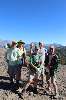
Telescope Peak, an
uncataloged peak at about 9000'
near the Bennett Juniper.
Pictured:  Mike, David, Wendy,
Gary & Ross. Photo by Barbara Dresslar