Sunday, August 19, 2018

Trip Report - Cooper Meadow, 8/4/18


Meadows and lakes abound on this trail


Oh, my.  What a fire season this summer.  The Carr Fire and the Mendocino Complex in Northern California; the Ferguson Fire persisting in Yosemite, all deadly and awful.  Now the Donnell Fire up on Highway 108, horribly destructive but not deadly – so far.  Heartbreak over the loss at Dardanelles Resort.Hope, love, and admiration to the firefighters struggling to save themselves and beloved Baker Station, Kennedy Meadows, and other structures in the area.

Deterred by the Ferguson Fire, which closed Yosemite including Hetch Hetchy and nixed our planned hike to Wapama Falls, we chose Cooper Meadow as Plan B.  The previous two weeks had been a bleak approximation of nuclear winter, and hike morning was dingy with smoke again.  A new fire, named the Donnell Fire, had started a day or two before.  As it was small (about 500 acres) and well east of our destination, we didn’t feel silly hoping for clear skies, or thinner smoke at least, at the 8,000’ trailhead.

When you see this pond, you're
almost there -- just downhill on
loose dirt then a short walk
through the forest to the meadow
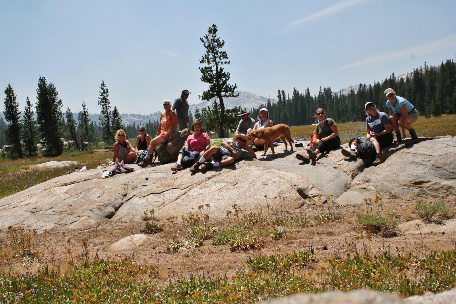
Lunch break in the meadow


Most scenic view you ever
had from an outhouse!
And were we rewarded!  Blue skies! Deep green trees!  Bright green, grassy meadows!  Wildflowers of all colors!  Red volcanic outcroppings to the north and grey granite mountains to the south!  We had a short, steep-ish uphill section to a long hilly section shaded by tall pines opening up to expansive views as we passed several meadows, ponds, and traversed a hillside.  There was a final downhill scramble before we walked out to Cooper Meadow and its historic ranch buildings.  W.F. Cooper began grazing cattle here in 1861.  In 1912, the Cooper Meadow grazing allotment ceded to the Sanguinettis.  They still use it, and there was evidence of habitation as we approached – dogs, a tethered horse, an
Castle Peak and the Three Chimneys

exterior bathroom sink setup, a new padlock on the “house.”  The ranch buildings date from the 1860s and were entered into the National Register of Historic Places in 2009.  The real “eye candy” is the close-up view of our iconic Castle Rock and the Three Chimneys formation.  We picnicked on gigantic rocks in the meadow and explored streams that form the headwaters of the South Fork Stanislaus River.  Then it was time to return to the trailhead heading back out the way we came in – again with a tough uphill section, but this time after a good rest with good friends in a gorgeous setting.

Cooper Meadows is about a 7-mile round trip hike accessed from the Coyote Meadow Trailhead, off of Herring Creek Rd., east of Strawberry.  To get to the trailhead, take Highway 108 east past Strawberry; turn RIGHT on Herring Creek Rd and SET YOUR ODOMETER.  Herring Creek Rd. becomes 4N12 at 4.5 miles and becomes dirt at 5.5 miles then hits a "T" at 6.8 miles.  At the T turn RIGHT and go about .1 mile to a "Y" and stay RIGHT on 4N12.  At about 9.5 miles veer LEFT to stay on 4N12 (DO NOT go right onto 5N31).  At 11.3 miles turn RIGHT on 5N67 for about .6 mile.  Turn LEFT and park when you see the "Coyote Meadow Horse Camp" sign (12.3 miles from Highway 108).  Google Maps can take you there; get directions to Coyote Meadows, CA  95364.  Use a paper map and these written directions as a back-up!  The road is rough with some deep holes; be sure to drive something with decent clearance such as a Subaru Outback or an SUV or truck (NOT a Honda Civic!).

Here are a couple of links to interesting Tuolumne County Historical Society website pages.  One has a neat old photo of horses and riders at Cooper Meadow http://tchistory.pastperfectonline.com/photo/793D8C3A-D697-4AB9-B6B9-170441802630
and our local heritage sites on the National Register of Historical Places http://www.tchistory.org/TCHISTORY/Register.htm

Happy Trail Heads at hike's end


Monday, August 6, 2018

Trip Report – Wapama Falls, 8/4/18, CANCELLED due to fire


Due to the Ferguson Fire, the 8/4/18 hike destination was changed to Cooper Meadow.  We hope to do this hike later in the year as a “bonus.”  For now, hope for the safety and success firefighters and donate to relief efforts of the American Red Cross, Lions Club, or other worthy organizations.

Friday, August 3, 2018

8/3/18 -- Fact Finding Mission to Coyote Meadows TH


8/3/18 -- Took a drive to scope out the route to the Coyote Meadows Trailhead which we'll use for tomorrow's hike to Cooper Meadow.  The dirt section of the road is DEFINITELY HIGH-CLEARANCE REQUIRED!  The directions and mileages in the post about the hike are all good.  Only thing to bear in mind is when you get to the Trail of the Gargoyles/Herring Reservoir Campground area, it becomes minorly confusing.  Just stay right through this little jog in the road and continue with the directions as written.  If you're a GPS user, the trailhead coordinates are N 38,14.429' W 119,52.776'.
Well-marked turn onto 5N67

Coyote Meadows Trailhead

We left Sonora in what looked like a nuclear winter.  The smoke thinned as we gained elevation (and that you do, for sure; at the intersection of Hwy 108/Herring Creek Rd, it's about 6000' and at the trailhead it's 8405').  It was pretty at the trailhead, and the doggos had a fun, short run.

Happy dogs on pretty trail
See you tomorrow, I hope!

Thursday, August 2, 2018

Aug. 4, 2018 hike to Cooper Meadow (NOT Wapama Falls)


Historic ranch outbuilding and implements
 at Cooper Meadow


As you know, Yosemite, including Hetch Hetchy -- where we were supposed to hike on Saturday -- has been closed due to the Ferguson Fire.  We have a Plan B, though:  Cooper Meadow, east of Pinecrest.  I chose Cooper Meadow because the difficulty and distance is similar to what we expected for the Wapama Falls trail.  With just about a 500’ elevation increase, it’s fairly level.  While Wapama is moderately-easy, Cooper Meadow is definitely moderate due to elevation (around 8400’) and distance (7.25miles).  As far as the smoke goes, we’ll just have to hope for the best.


Castle Peak & the Three Chimneys from
Cooper Meadow
If you have respiratory issues, please stay home on Saturday!  I hope you can join us, though, because I think you’ll fall in love with this trail.  We’ll walk through evergreen forest with stands of aspen (come back for the fall color) and a few minor stream crossings (these feed the South Fork Stanislaus headwaters).  We’ll skirt Horse and Cow Meadow where the vista opens up to the familiar but always stunning volcanic formations: Three Chimneys, Castle Rock, Eagle Peak.  At our destination, historic ranch buildings dating from the 1870s are nestled in vast, mountain-ringed Cooper Meadow (maybe green and flower-filled).


Bring insect repellant (“meadow” means “mosquitoes maybe”).  Wear a hat, sunscreen and layers.  Bring water and snacks/lunch.  On-leash dogs are welcome.  We should be back to Sonora by 5.

The trailhead for this hike is only about 50 miles from Sonora, but the last third is on unpaved forest roads.  Those without high-clearance vehicles are encouraged to ride-share.


Carpool/caravan info:

1st stop/meeting point: Starbuck’s at the Junction in Sonora; meet at 7:45am; leave at 8am

2nd stop/meeting point: Mi-Wok Ranger Station, Me Wuk Village; meet at 8:15; leave at 8:30

Or meet at the trailhead at 9:30am:  Coyote Meadows/Coyote Meadow Horse Camp Trailhead.  Take Highway 108 east past Strawberry; turn RIGHT on Herring Creek Rd and SET YOUR ODOMETER.  Herring Creek Rd. becomes 4N12 at 4.5 miles and becomes dirt at 5.5 miles then hits a “T” at 6.8 miles.  At the T turn RIGHT and go about .1 mile to a “Y” and stay RIGHT on 4N12.  At about 9.5 miles veer LEFT to stay on 4N12 (DO NOT go right onto 5N31).  At 11.3 miles turn RIGHT on 5N67 for about .6 mile.  Turn LEFT and park when you see the “Coyote Meadow Horse Camp” sign (12.3 miles from Highway 108).  Google Maps can take you there; get directions to Coyote Meadows, CA 95364.  Use a paper map and these written directions as a back-up!

Thursday, July 12, 2018

TCT #8 -- Wapama Falls, Hetch Hetchy, Yosemite NP

Wapama Falls, Hetch Hetchy (Yosemite NP)


John Muir, Yosemite's biggest fan, adored the Hetch Hetchy Valley, calling it "one of Nature's rarest and most precious mountain temples." On Saturday, August, 4, we get to visit one of the most lovely features in the Hetch Hetchy area of Yosemite National Park, Wapama Falls.


As post-Gold Rush San Francisco boomed, the scant local water supply became a problem.  The city started casting about for a likely river to dam to meet its needs. In 1908, San Francisco was devastated by the great earthquake, but it was the subsequent fire that's said to have wreaked the greatest damage, and the city's water problem moved from chronic to critical.  Enter an idea born in 1882 -- dam the Tuolumne River at Hetch Hetchy Valley and route the water to San Francisco.  The only problem required an act of congress to resolve -- Hetch Hetchy was protected in Yosemite National Park.  After a five-year resistance campaign by the Sierra Club and John Muir, President Woodrow Wilson signed the Raker Act of 1913, and the dam was completed 10 years later (and raised 15 years after that).

John DeGrazio in the
Yosemite"Tunnel View" Bear cap.
Sales benefit the Yosemite NP
Bear Management Team. 
At 5 miles, the hike to Wapama Falls and back is one of the easiest in Yosemite National Park.  However, in summer, I'd call it "moderately-easy."  Though there is little elevation gain, the heat will be a challenge adding difficulty.  Bring plenty of water.  Wapama Falls is the second-tallest waterfall in Yosemite National Park and one of the top twenty in North America.  At lake level, the falls spreads out into three or four channels traversed by footbridges.  To learn more about our destination,
I reached out to John DeGrazio, founder of YExplore Yosemite Adventures and host of KAAD-LP's "Yosemite Can O Peaches" program.  For 12 years, John and YExplore's professional guides have been leading personalized backpack, birding, wildflower, snowshoe, and photography trips into every corner of Yosemite (for more info about YExplore, here's a link to their website: https://www.yexplore.com/).  For all he's seen of our national jewel, John says the Wapama Falls hike is one of his favorites.  If he's not out on another Yosemite adventure, John will be joining our August 4th trip.  Not to cost you any bookings, John, but I sure hope you can make it!  In TCT #8, John paints a vivid picture of Wapama Falls, Hetch Hetchy, and the Twain Harte ditch.  You read that correctly; we did our interview al fresco, and John in true naturalist fashion found something remarkable at every bend in our trail.  TCT #8 also features "Three T" trail reviews (what was tough, trippy and tremendous?) of our high country hike to Relief Reservoir.


Tuesday, July 10, 2018

Trip Report - Relief Reservoir, Kennedy Meadows, 7/7/18

Anticipated summer crowds on the popular Relief Reservoir trail failed to materialize, and we had an outstanding post-holiday high country hike!  The trail starts just east of the Kennedy Meadows Resort and Pack Station.  Hilly at first, it follows the Middle Fork Stanislaus River upstream to one of the meadows.  Soon you enter the Emigrant Wilderness and with the benefit of steps hacked out of the granite, you begin your ascent along the stream, which you will cross twice via sturdy footbridges. 


First footbridge over
Middle Fork Stanislaus River
 
All along the way you'll see discarded material from the construction of the dam (1907-1911).  Indeed, some of the trail takes the old road and railroad built to move construction material.  Besides manmade artifacts, there's stunning natural scenery: Trees, some appearing to grow straight out of immense granite boulders; Wildflowers along the trail and in cracks and meadows; Birds singing and chirping; Craggy, snowy mountain peaks; Water in creeks cascading down the canyon walls and, in some seasons, spilling over the trail.


The steep incline inspired some of us to take more "beauty breaks" than others, so the group ended up pretty spread out.  So much so that the advance wave missed the turn around point and added some extra mileage.  We intercepted most of the faster Trail Heads at about the 4.5 mile point at the Grouse Creek crossing and directed them back to the north end of the reservoir to reconvene at an overlook.  Once reunited, we scrambled down to the dam to survey the surroundings at lake level then scrambled back up to the trail for a group photo.


Trail Heads on the dam
Southern view of
Relief Reservoir
at dam level
The Kennedy Meadows trailhead, about 57 miles east of Sonora, is your gateway for many adventures in the Emigrant Wilderness including trails to Sharon Lake, Kennedy Lake, Upper and Lower Relief Valleys, Brown Bear Pass, and more including our hike to Relief Reservoir.  Turn off of Highway 108 at the road to Kennedy Meadows Resort and Pack Station.  From here, it's about .5 mile to the trailhead parking lot (a bit past Baker Campground on your left).  There is plenty of parking and a vault toilet.  Walk .5 mile along the trail/road from the parking lot past the resort to the actual trailhead.  This is a strenuous hike starts at 6,127' and gains 1,200' over about 3 miles to the reservoir.  In the summer it's a hot AND popular hike, so it's good to get an early start if you're venturing out on a weekend or holiday.  Because this is such a heavily trafficked route and shared with equestrians, it's essential to know trail-yielding conventions:  Downhill hikers yield to uphill hikers; large groups yield to smaller groups or solo hikers; bikers yield to pedestrians and everyone yields to horses.  When horses appear, step off the trail on the down-slope side; don't reach out to touch the horses.


Here's a link to the Stanislaus National Forest's Highway 108 hiking trails webpage:


Here's a link to the Tuolumne County Historical Society webpage about Relief Reservoir:

Tuesday, July 3, 2018

NOTICE -- Two (2) hikes to Relief Reservoir, 7/7 & 7/14

Immerse yourself in history -- and rugged beauty -- on this hike into the Emigrant Wilderness where the Clark-Skidmore wagon train of 1852 was stranded without supplies as they crossed the Sierras to the Southern Mines. At just over 7 miles round trip, this trail is demanding due to the high elevation and steep, steady ascent of 1200’ to a high point of 7360’.


There are two, count 'em 2, hikes offered -- 7/7 and 7/14.  Same details, different days:

It may be hot; bring plenty of water. Bring lunch for a picnic at the reservoir. On leash dogs OK. This will be a strenuous hike.

Two stops on the carpool/caravan:
First stop/meeting point - 6:45am at the Starbuck's in the Junction; leave at 7am
Second stop/meeting point - 7:15 at the Mi Wuk Ranger Station; leave at 7:30
Or meet at the trailhead parking lot at Kennedy Meadows on the left just before the resort and pack station. Hike starts at 8:30.